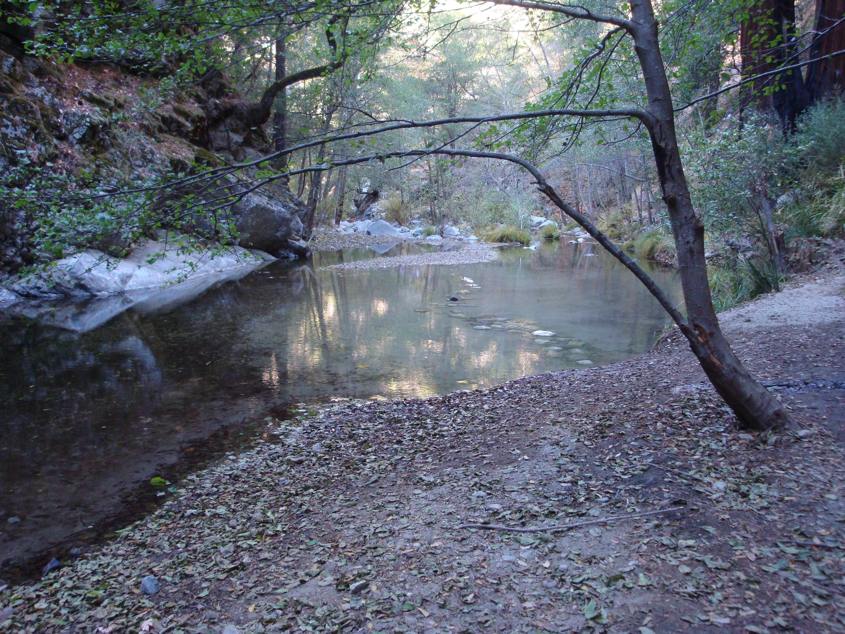
The Big Sur River
The USGS has announced that the Big Sur River Gauge will be shut down on October 31, unless funding is somehow located to keep it in operation. Read the rest of this entry »
The Big Sur River
The USGS has announced that the Big Sur River Gauge will be shut down on October 31, unless funding is somehow located to keep it in operation. Read the rest of this entry »
 Leave a Comment » |
  Big Sur, Santa Lucias |
  Permalink
 Posted by xasauan
Big Sur’s Cone Peak rises out of the ocean about as steeply as any mountain on the planet. It’s summit, at 5,155 feet, lies less than 3 miles, as the condor flies, from the beach. This delivers an average gradient of around 33%; steeper than the rise of Mt. Whitney from the floor of Owens Valley. Making the journey from the beach to the summit on foot takes only a little over 5 miles, thanks to the open slopes of Stone Ridge. And it’s one of the most spectacular walks in Big Sur. Which is saying something.
1 Comment | Big Sur, Insects, On Foot, Plants, Santa Lucias, Wildflowers | Permalink
Posted by xasauan

Sykes Hot Springs: Only memories remain
The Forest Service announced today that Sykes Hot Springs have run dry, apparently as a result of a small earthquake centered in the Ventana backcountry. Read the rest of this entry »
8 Comments | Big Sur, Santa Lucias | Permalink
Posted by xasauan

Not much water flowed into the Carmel River Lagoon
Last week’s rain marked the first serious winter storm to hit the Monterey Peninsula and Big Sur Coast since December, 2012. It was badly needed.
1 Comment | Big Sur, Carmel River, Fire, Flood & Apocalypse, Santa Lucias, Water | Tagged: carmel river, Lake Nacimiento, Lake San Antonio, Nacimiento River, Salinas Valley Groundwater Basin, Salinas Valley Water Project, Saltwater Intrusion, San Antonio River | Permalink
Posted by xasauan
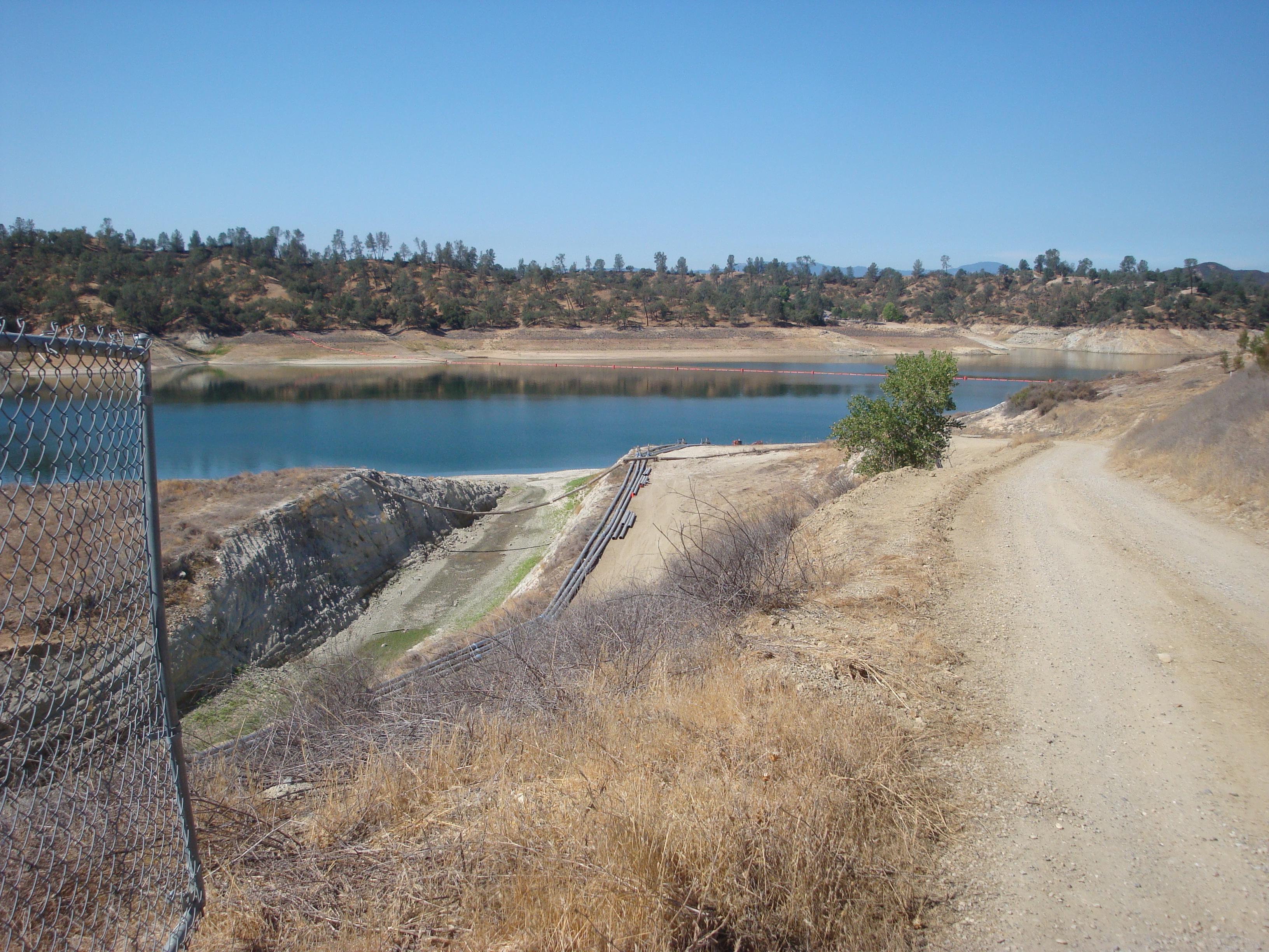
Lake Nacimiento
The Reservoir Operations Committee of the Monterey County Water Resources Agency Board meets today to discuss options for dealing with the shrinking San Antonio and Nacimiento reservoirs.
Leave a Comment » | Big Sur, Carmel River, Fire, Flood & Apocalypse, History, Politics, Santa Lucias, Water | Permalink
Posted by xasauan
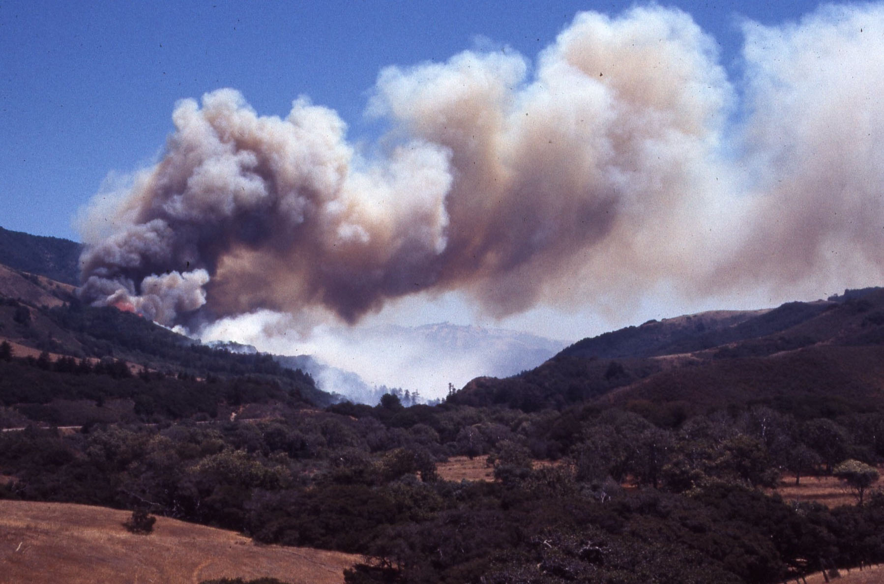
The 1972 Molera Fire burning in the Big Sur Valley
Three years ago we wrote: “Big Sur’s real nightmare fire scenario is not a massive fire escaping from the Wilderness, but a fire carelessly started along Highway One that makes a quick run up one of the inhabited canyons before a major firefighting effort can be launched.”
The Pfeiffer Ridge Fire wasn’t quite that nightmare scenario, but it was close. Like the explosive Molera Fire, in 1972, it started along the Highway and reached inhabited areas so quickly that those closest to the fire front had only minutes to choose between fleeing for their lives or staying on to fight with whatever resources they happened to have on hand. Read the rest of this entry »
1 Comment | Big Sur, Fire, Flood & Apocalypse, Santa Lucias | Permalink
Posted by xasauan

Sycamore Canyon and the Big Sur Valley. Pfeiffer Ridge is at the back of the Sycamore Canyon drainage, running parallel to, and just to the west of, Hwy. 1. Pfeiffer Beach is at the bottom of the photo.
As many of you have been pointing out to us this morning. A fire broke out on Pfeiffer Ridge last night and has been burning through the Sycamore Canyon drainage toward the ocean. We’ve seen reports of as many as 500 acres burned and structures, including homes, have reportedly been destroyed. Read the rest of this entry »
2 Comments | Big Sur, Fire, Flood & Apocalypse, Santa Lucias | Permalink
Posted by xasauan
2 Comments | Big Sur, On Foot, Santa Lucias | Tagged: Big Sur, Big Sur River, Logwood Creek, Pine Ridge Trail, Sykes Hot Springs | Permalink
Posted by xasauan
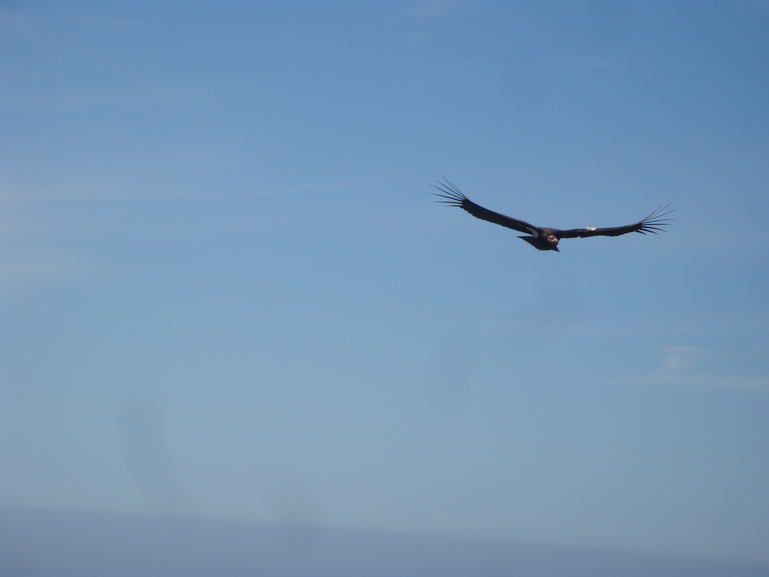
El Condor Pasa
If you’re like us, you probably assume the biologists, veterinarians, technicians, and volunteers working tirelessly to save California condors from extinction do it because they care deeply about the condors and their place in the web of life. It turns out, though, that the real agenda of the Condor Recovery Program is to disarm the American people preparatory to imposing the enviro-fascist mandates of UN Agenda 21. That’s what we’ve been reading in the comment sections of dozens of online periodicals, anyway.
1 Comment | Big Sur, Fire, Flood & Apocalypse, Politics, Santa Lucias | Tagged: condors, lead ammunition, lead poisoning | Permalink
Posted by xasauan
With the last rainy season fizzling out in January, it seems like it’s been summer for about eight months now. Plenty of time to paddle, pedal, and roam around in the hills — which is why we haven’t been posting here much. Don’t worry, though. We promise to turn our jaundiced eye back to water and development issues again someday soon. Maybe when the rains begin to fall.
In the meantime, here’re a few clues as to what we’ve been up to …

Trail near the summit of Cone Peak. Coast partially obscured by smoke from an escaped controlled burn on Ft. Hunter Liggett. Read the rest of this entry »
1 Comment | Big Sur, Cycling, On Foot, Santa Lucias, Transportation | Tagged: Cone Peak, Ft. Ord blight, Nacimiento River, outrigger canoe, pagani, sunset, The Indians, Wagon Cave | Permalink
Posted by xasauan
You are currently browsing the archives for the Big Sur category.
| Chasing the Sun on A Visit to La Cueva Pinta… | |
| peter d niemi on Flashback! Spring Equinox Cele… | |
| danacarnazzo on Remembering the 1983 Big Sur… | |
| Kathy Tyacke on Flashback! Spring Equinox Cele… | |
| Jim on Wildflower of the Week: Silver… |