Big Sur’s Cone Peak rises out of the ocean about as steeply as any mountain on the planet. It’s summit, at 5,155 feet, lies less than 3 miles, as the condor flies, from the beach. This delivers an average gradient of around 33%; steeper than the rise of Mt. Whitney from the floor of Owens Valley. Making the journey from the beach to the summit on foot takes only a little over 5 miles, thanks to the open slopes of Stone Ridge. And it’s one of the most spectacular walks in Big Sur. Which is saying something.
Cone Peak Directissima: Going Sea to Sky on Big Sur’s Stone Ridge
June 16, 2014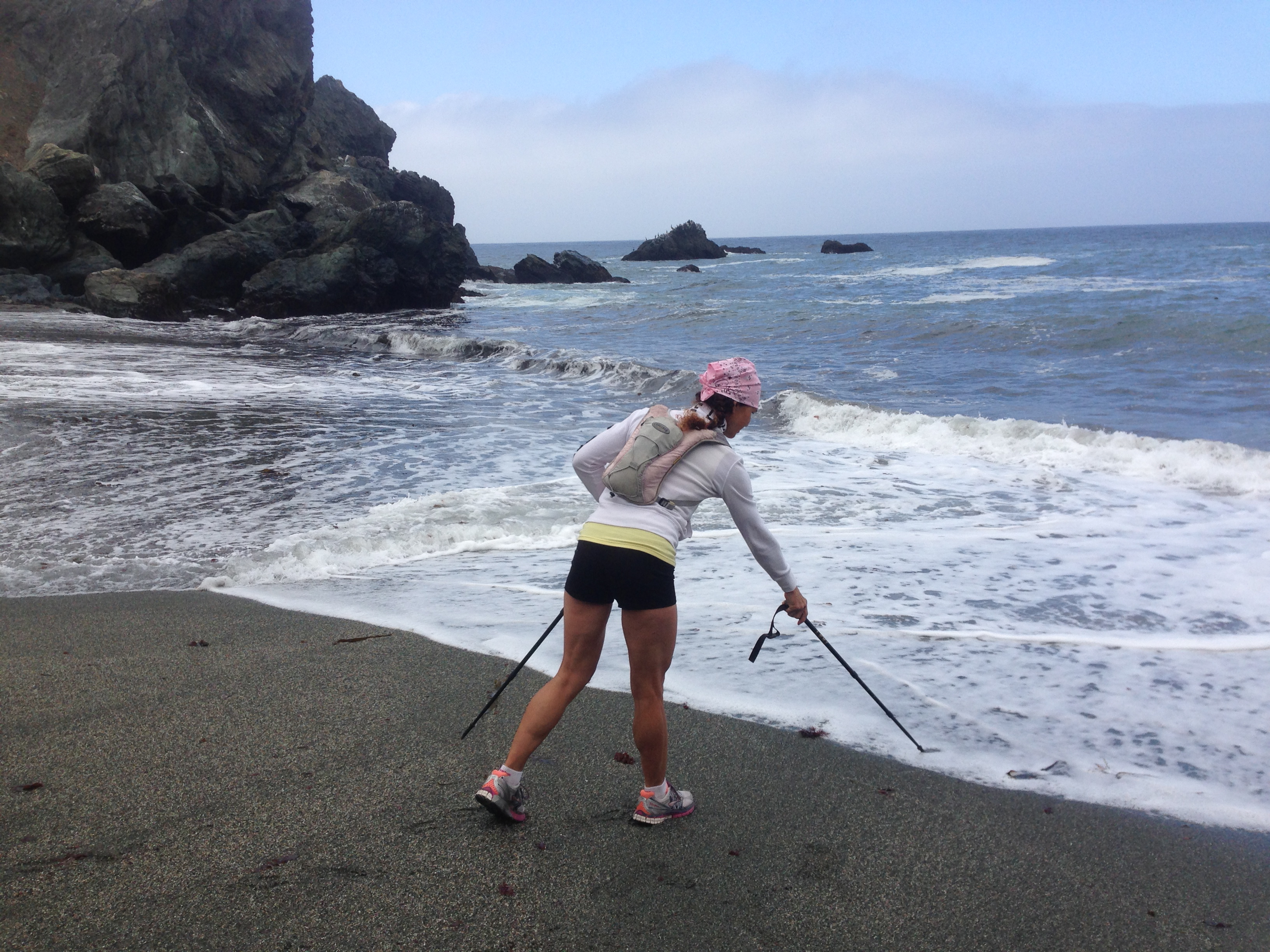
 1 Comment |
  Big Sur, Insects, On Foot, Plants, Santa Lucias, Wildflowers |
  Permalink
 Posted by xasauan
Blue Moon Rising
August 31, 2012
August in Big Sur Read the rest of this entry »
2 Comments | Big Sur, Insects, Plants, Santa Lucias, Wildflowers | Permalink
Posted by xasauan
Wildflower of the Week: Silver Lupine
March 26, 2012
Well, we’ve fallen a little behind in choosing a wildflower of the week, so we’re going to make up for it by choosing silver lupine (Lupinus albifrons): one of California’s most ubiquitous flowers. Although it leaks across the border a little into Southern Oregon and Northern Baja, this perennial shrub is a true Alta Californian. These are blooming near Soberanes Creek in Garrapata State Park – one of the many State parks scheduled to be “closed” this year. Read the rest of this entry »
6 Comments | Big Sur, Insects, Plants, Santa Lucias, Wildflowers | Permalink
Posted by xasauan
South Fork Little Sur
June 12, 2011
There’s no sign, but the Little Sur Trail begins at this easily recognized gate on the Old Coast Rd. Just take the Old Coast Rd. north, a little under 4 miles, from its south end at Andrew Molera State Park. Read the rest of this entry »
4 Comments | Big Sur, Fungus, Insects, On Foot, Plants, Santa Lucias, Wildflowers | Permalink
Posted by xasauan
East Garland Wildflowers
April 30, 2011Here’s a little of what we saw today …

Chinese Houses (Collinsia heterophylla) Read the rest of this entry »
4 Comments | Insects, On Foot, Plants, Santa Lucias, Wildflowers | Tagged: Carmel Valley, Garland Regional Park | Permalink
Posted by xasauan
East Molera & Post Summit
March 13, 2011
The East Molera Trail begins with a moderate climb through live oak woodlands… Read the rest of this entry »
2 Comments | Big Sur, Insects, On Foot, Plants, Santa Lucias, Wildflowers | Tagged: Andrew Molera State Park, Big Sur, Big Sur wildflowers, Pico Blanco, Post Summit | Permalink
Posted by xasauan
Eleven Years at Alta Vista: Jeff Norman’s Journals
February 25, 2011
On January 1, 1980, Jeff Norman, then 29, moved into the Overstrom homestead, Alta Vista, in Big Sur. Overlooking the ocean from a 2,700-foot-high perch on Michael Ridge, and accessible only by trail, Alta Vista was an ideal location for observing and experiencing the beauty and power of the natural world. Jeff lived at Alta Vista until his death, at age 56, on October 31 2007. All structures associated with Alta Vista were burned to the ground eight months later in the Basin Complex Fire. Read the rest of this entry »
8 Comments | Big Sur, Fire, Flood & Apocalypse, Fungus, History, Insects, Plants, Santa Lucias | Permalink
Posted by xasauan
On the Little Sur
November 14, 2010
The North Fork of the Little Sur River, El Río Chiquito del Sur, passes between the lower slopes of Pico Blanco and Bixby Mountain on its way to the sea. Read the rest of this entry »
5 Comments | Big Sur, Insects, On Foot, Plants, Santa Lucias | Permalink
Posted by xasauan
September on Mt. Manuel
September 19, 2010
A walk up the Mt. Manuel Trail (or Manuel Peak Trail, if you prefer) can be brutal on a hot summer day. That’s why we waited for a mild autumn day to make the trip. Notice how the deerweed (Lotus scoparius) that turned these hillsides yellow when it was in bloom a few months ago has now turned the hills a rusty brown as the flowers dry out. Read the rest of this entry »
3 Comments | Big Sur, Insects, On Foot, Plants, Santa Lucias, Wildflowers | Permalink
Posted by xasauan
Into the Chalk Fire Burn: Vicente Flat Trail
May 17, 2009
The Vicente Flat Trail is in excellent condition as it leaves Highway 1 and begins its initial 1600 ft. climb. Read the rest of this entry »
2 Comments | Big Sur, Fire, Flood & Apocalypse, Insects, On Foot, Plants, Santa Lucias, Wildflowers | Permalink
Posted by xasauan
