At the moment the Tassajara Fire ignited we were hundreds of miles away, relaxing in a hot spring at the eastern foot of the Warner Mountains. In front of us lay a small marsh, buzzing with dragonflies and birds. Beyond that, the vast deserts of the Great Basin. Behind us, the sun slowly sank beneath the rough spires of the Warner crest. Read the rest of this entry »
The Tassajara Fire from Afar
September 24, 2015
 2 Comments |
  Fire, Santa Lucias | Tagged: Cachagua, Finch Creek, Tassajara Fire |
  Permalink
 Posted by xasauan
Residential Water Use on the Monterey Peninsula Reaches Embarrassing Levels
August 10, 2015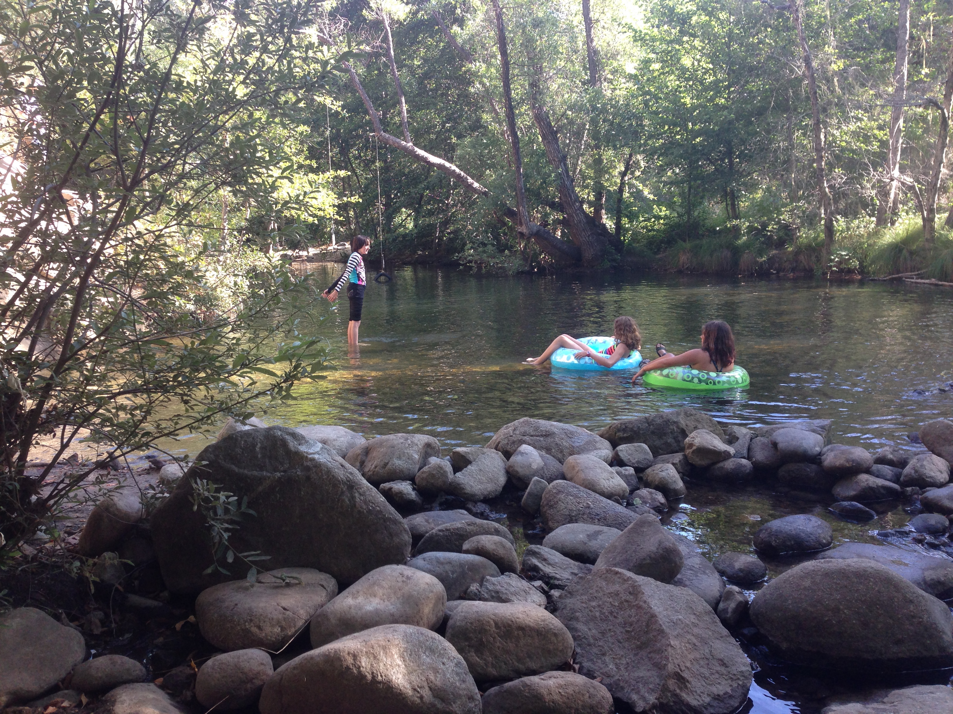
Summer on the Carmel River
The June residential use figures for cities and water districts around the state are out and the Monterey Peninsula has little to be proud of. A whopping 56 California communities did better than the Monterey Peninsula at residential water conservation in June, making a mockery of local officials’ oft repeated claims that the Peninsula is the state’s water conservation leader.
Monterey Peninsula residents used 66.1 gallons per person per day in June, dropping the Peninsula into a 57th place tie with Morro Bay. In May, Peninsula residents used 58.8 gallons per person per day and came in 48th. In April it was 55.8 gallons and 29th place.
It’s understandable that residents of the Monterey Peninsula, burdened by so many lavishly watered estates, would have a hard time using less water than places like San Francisco, San Diego, Inglewood and Compton, but how do we explain using almost four gallons more per person per day than a place like Burlingame; a wealthy Silicon Valley bedroom community where the median family income is $113,440, the climate is hotter and drier, and extensively landscaped properties abound?
The best performance in June was turned in by the Southern California city of Lynwood, where residents used only 35.3 gallons per person per day. Second place went to our own neighbor to the south, Cambria, where figure was 37.1. Santa Cruz was, once again, the best of the Monterey Bay area, at 42.7, and King City was, once again, the Monterey County leader, at 48.8.
Given our increasingly urgent need to impress the State Water Resources Control Board with the Peninsula’s seriousness about reducing its illegal pumping of the Carmel River, it’s too bad local officials aren’t doing more to make conservation a priority. Empty words about our water conservation leadership aren’t likely to impress a Water Board that now tracks and publishes the cold, hard facts on a month by month basis.
5 Comments | Carmel River, Fire, Politics | Permalink
Posted by xasauan
Lightning Moving Ashore
August 6, 2015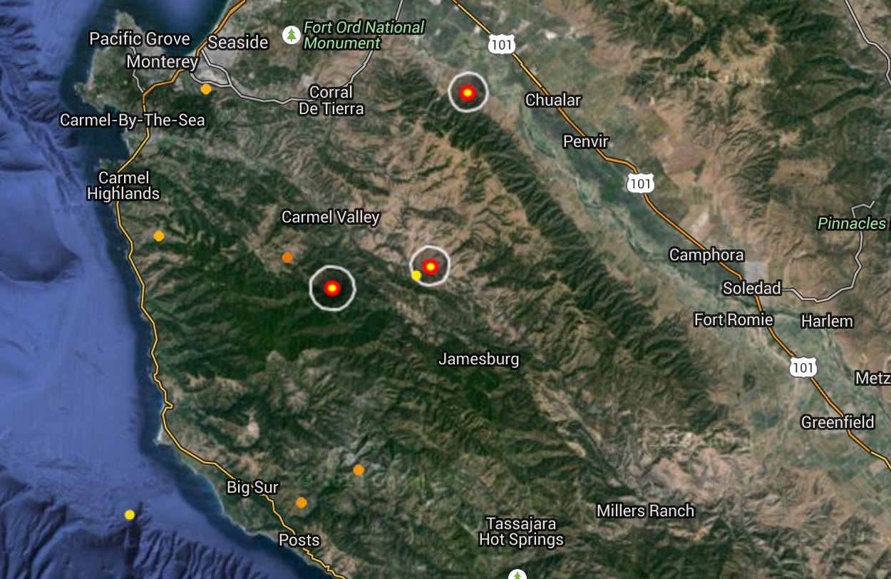
(Image from Lightningmaps.org)
Lightning began a little before 8:00 this evening and is now striking across the Northern Santa Lucia Mountains from Big Sur to the edge of the Salinas Valley. Let’s hope there’s some rain falling with it.
11:00 pm Update: Reports of fire at the radio towers on Mt. Toro and at Willow Creek on the South Coast. Mt. Toro fire is probably out by now. Good chance that the Willow Creek fire will be quickly extinguished, as well. No telling what may still be smoldering out there. There’ve been plenty of backcountry lightning strikes this evening.
2 Comments | Big Sur, Fire, Santa Lucias | Permalink
Posted by xasauan
Remnants of Hurricane Dolores Bring Lightning and Rain
July 19, 2015
Lightningmaps.org image depicting lightning strikes detected between 6:30 and 7:30 this morning. The storm reached our area around 4:30 am and was still producing some strikes, mainly offshore, at 9:00 am.
The remnants of Hurricane Dolores, which brought intense thunderstorms to Southern California yesterday, reached the Northern Santa Lucias, Carmel Valley, and the Monterey Peninsula early this morning. While heavy rain fell in some areas, it doesn’t appear to have lasted long enough to produce significant totals. No Monterey County rain gauge seems to have received much more than a couple tenths of an inch, and most received only hundredths of an inch. Read the rest of this entry »
3 Comments | Big Sur, Fire, Santa Lucias | Permalink
Posted by xasauan
Peanut Fire Burning at Ft. Hunter-Liggett
June 11, 2015
Heat detections recorded around 2:00pm today
Presumably as a result of yesterday’s lightning, there is at least one fire, dubbed the Peanut Fire, now burning at Ft. Hunter Liggett. The fire is said to be in the Stony Valley area, along the Nacimiento-Fergusson Rd. That would correspond with the upper three heat detections shown above. No telling whether the lower detections are a separate fire or not. Read the rest of this entry »
Leave a Comment » | Big Sur, Fire, Santa Lucias | Permalink
Posted by xasauan
Lightning Detected in Ventana Wilderness
June 10, 2015
LightningMaps.org map showing approximate location of lightning strike near the headwaters of the North Fork Big Sur River.
A thunderstorm is now moving over the Ventana Wilderness and, in addition to the strike depicted above, lightening strikes have been detected near Pinyon Peak, just downstream from Lost Valley and, most recently (3:00 pm), in the wild country between Zig Zag and Willow Creeks and near San Antonio Camp.
A far more vigorous storm has been working over the Southern Diablo Range near Coalinga and Ft. Hunter-Liggett has also reported downstrikes.
Let’s hope there’s some significant rain falling. It’s pretty dry out there.
June 11 2015 Update: No fires have yet appeared in the Ventana Wilderness as a result of yesterday’s lightning, but a fire, named the Peanut Fire, is now burning near the Nacimiento-Fergusson Rd. in Ft. Hunter-Liggett. As of noon today, it had burned 700 acres and there are rumors that it may burn as much as 3,000 acres before it’s through. No word on the situation with the NF road, but it is probably safe to assume it is closed through the fort.
Leave a Comment » | Big Sur, Diablo Range, Fire, Gabilans, Santa Lucias | Permalink
Posted by xasauan
Water Agency Sets Meeting to Discuss State of the Basin Report
May 23, 2015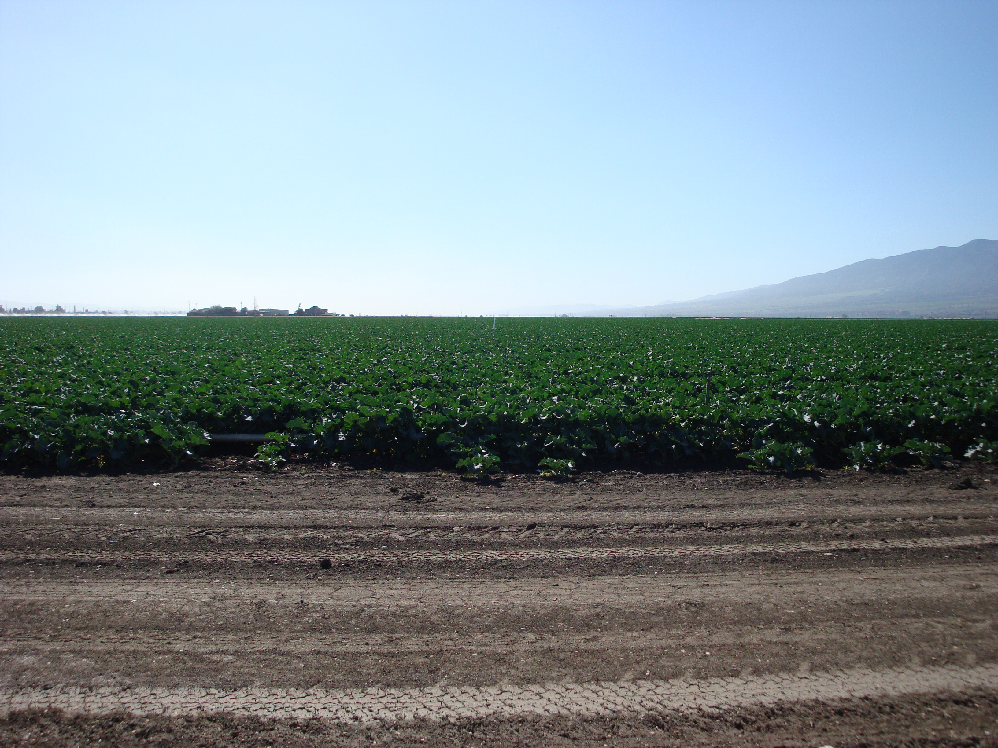
The Salinas Valley
The Monterey County Water Resources Agency is inviting the pubic to attend a workshop on Tuesday, May 26, at the Monterey County Office of Education Meeting Rooms, 901 Blanco Circle, in Salinas, where the findings of the State of the Salinas River Groundwater Basin Report will be “discussed and clarified.” Read the rest of this entry »
Leave a Comment » | Fire, Politics, Water | Permalink
Posted by xasauan
