Soberanes Fire: Week Three

August 5, 2016

For more recent updates, please see Soberanes Fire: Week Four

Important caveats: Please note that the squares on the heat detection maps represent the expected margin of error, not the size of the area burned. In other words, the detection could have come from anywhere within the square. Also be aware that false detections do sometimes occur. An outlying or “over the line” heat detection is not, by itself, a confirmation that there is fire in the area indicated. In addition, the satellites do not detect heat everywhere that fire exists. Creeping, backing or smoldering fire is often not detected. Finally, the detections are only snapshots of moments in time. Flare ups that occur before or after a satellite pass may be entirely missed.

Also be aware that yellow squares disappear from the map after 6 days. These are not maps of the area burned since the fire began, just maps of where heat has been detected during the past week. Read the rest of this entry »


Soberanes Fire: Week Two

July 29, 2016

For more recent updates, see Soberanes Fire: Week Three and Soberanes Fire: Week Four

IMG_2676

For earlier maps and notes see Soberanes Fire: Week One

Important caveats: Please note that the squares on the heat detection maps represent the expected margin of error, not the size of the area burned. In other words, the detection could have come from anywhere within the square. Also be aware that false detections do sometimes occur. An outlying or “over the line” heat detection is not, by itself, a confirmation that there is fire in the area indicated. In addition, the satellites do not detect heat everywhere that fire exists. Creeping, backing or smoldering fire is often not detected. Finally, the detections are only snapshots of moments in time. Flare ups that occur before or after a satellite pass may be entirely missed.

Also be aware that yellow squares disappear from the map after 6 days. These are not maps of the area burned since the fire began, just maps of where heat has been detected during the past week. Read the rest of this entry »


Soberanes Fire: Week One

July 22, 2016

For more recent updates, please see Soberanes Fire: Week Two,  Soberanes Fire: Week Three and Soberanes Fire: Week Four

Thursday 7-28-16 8:00 pm Update:

7-28pm

Lots of smoke coming from the fire today and there’s no doubt about where most of it was coming from… Read the rest of this entry »


Flashback! Julia Pfeiffer Burns in the 1960s

July 19, 2016

Just a few shots from the days before traffic jams and crowds…

Scan

At the Waterfall House with my mother and sister in 1966. Notice how the waterfall drops directly into the ocean. The beach formed after a 1983 landslide put a huge amount of material into the ocean just to the north.

JG 1

Mom and Sis on the terrace.

Brown House

Leading Mom around the house (I think this photo is from 1963). To get there, we rode down from the Highway on the funicular car.


Salmon Creek: The Good, The Bad, and The Ugly

July 7, 2016

IMG_2489

Salmon Creek Falls

A massive surge in the number of visitors to Monterey County in general and Big Sur in particular has led to a large increase in the number of people camping along, and near, Highway One and other roads. While many of these people are, no doubt, careful to leave no trace of their visit, others light illegal campfires and leave their garbage strewn across the landscape. Read the rest of this entry »


The Campfire Conundrum

June 30, 2016

DSC09939

On a Sunday walk along the Pine Ridge Trail during Level IV fire restrictions in 2013, we looked at dozens of fire rings and couldn’t find a single one that hadn’t been used the night before. Read the rest of this entry »


Fire Season

May 28, 2016

pico-flames

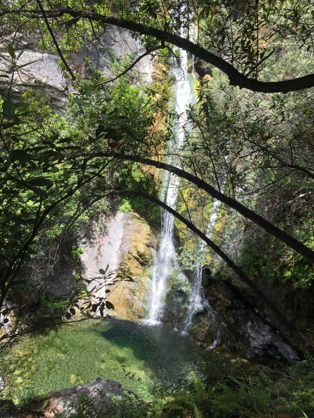
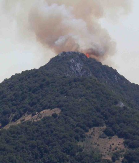
Pico Blanco crowned with fire. (Lloyd Jones photo)

The grass on the hills is turning brown, seasonal streams are disappearing, and swarms of face flies have emerged to launch their annual shock and awe campaign against backcountry travelers.

This can only mean fire season is upon us. As is traditional at the start of fire season, the media has begun warning that this fire season is expected to be especially bad – maybe the worst ever. In wet years, this prediction is based on the grass being high. In dry years, on the simple fact that things are dry.

In reality, no one really knows what kind of fire season we’ll have. This is because the amount of rain we do or don’t receive in the preceding rainy season is less important than the kind of weather we get in the summer. In years when there are a lot of warm, windy days with low humidity (which is another way of saying days when offshore flow pushes the marine layer out to sea), there are likely to be more, and worse, fires. Fires simply ignite more easily in these conditions and, once they ignite, spread much more quickly.

It’s also worth remembering that the three largest fires to burn in Monterey County over the past 50 years (Marble Cone, Kirk Complex and Basin Complex) were started by dry lightning. Dry lightning storms are relatively rare in our area, but when they do occur they can overwhelm firefighting resources by starting hundreds of fires at once. Obviously, there is no way to predict whether such an event will happen in any given year.

As vividly demonstrated by the December 2013, Pfeiffer Ridge Fire, fire danger isn’t even limited to fire season. Given the right conditions, serious fires can occur at any time of year.

So how about this year and every year we all just make damn sure we don’t let our catalytic converters, tow chains, weed whackers, wood stoves, electrical wiring, guns, etc. start any fires and, meanwhile, make our homes as fire resistant and defensible as reasonably possible?


Is a Garrapata State Park Trail Being Ceded to a Mexican Drug Cartel?

September 2, 2015

FOG

Yesterday morning, Friends of Garrapata, the volunteers who work tirelessly to keep Garrapata State Park wild and graffiti free, and its trails in usable condition, posted the above graphic to their Facebook page with the following text:

WARNING

Please stay clear of the Peak Trail until October.

While environmentally destructive backcountry marijuana grows are indeed a serious problem – that could be solved overnight by legalization – and it’s certainly worth being cautious while traveling off trail in places that might be attractive to growers, this post stands out as strange for several reasons. Read the rest of this entry »


Lightning Moving Ashore

August 6, 2015

8-13 copy

(Image from Lightningmaps.org)

Lightning began a little before 8:00 this evening and is now striking across the Northern Santa Lucia Mountains from Big Sur to the edge of the Salinas Valley. Let’s hope there’s some rain falling with it.

11:00 pm Update: Reports of fire at the radio towers on Mt. Toro and at Willow Creek on the South Coast. Mt. Toro fire is probably out by now. Good chance that the Willow Creek fire will be quickly extinguished, as well. No telling what may still be smoldering out there. There’ve been plenty of backcountry lightning strikes this evening.


Remnants of Hurricane Dolores Bring Lightning and Rain

July 19, 2015

730.2

Lightningmaps.org image depicting lightning strikes detected between 6:30 and 7:30 this morning. The storm reached our area around 4:30 am and was still producing some strikes, mainly offshore, at 9:00 am.

The remnants of Hurricane Dolores, which brought intense thunderstorms to Southern California yesterday, reached the Northern Santa Lucias, Carmel Valley, and the Monterey Peninsula early this morning. While heavy rain fell in some areas, it doesn’t appear to have lasted long enough to produce significant totals. No Monterey County rain gauge seems to have received much more than a couple tenths of an inch, and most received only hundredths of an inch. Read the rest of this entry »