Wildflower of the Week: Giant Trillium

February 28, 2018

Giant Trillium (Trillium chloropetalum), also known as Giant Wakerobin, is currently in bloom in the Santa Lucia Mountains. This plant is a true California native, inhabiting the coast ranges from Santa Barbara to Siskiyou, as well as the Sierra foothills. It is closely related to, but much larger than, the Western Wakerobin (Trillium ovatum) found in our coastal redwood forests.

Impossible to mistake for anything else, Giant Trillium consists of a robust stalk, rising as much as two feet above the ground, topped by the distinctive three leaves than make a trillium a trillium. The Giant Trillium’s single flower emerges directly from the branching top of the stalk and is not lifted above the leaves on a stalk of its own, as is the case with T. ovatum.

DSC00558

Giant Trillium
Read the rest of this entry »


Forest Service Lifts Fire Restrictions Just in Time for a Red Flag Warning

January 27, 2018

IMG_2266

7:30 pm; June 16, 2016: Sundowner winds blow the Sherpa Fire down from the Santa Ynez Mountains and onto the coastal terraces west of Santa Barbara (as viewed from the comfort of Cojo Anchorage). Dry season conditions of this kind have been common so far this winter.

The Los Padres National Forest covers about 1.75 million acres. The northern boundary, near Carmel Valley, is over 200 miles from the Forest’s southernmost point, near Los Angeles. As fire restrictions are imposed Forest-wide, strict prohibitions on campfires tend to remain in place in the Big Sur area, even after substantial rain, so long as the southern end of the Forest remains dry.
Read the rest of this entry »


How to Sneak Into Sykes Hot Springs

December 6, 2017

DSC09948

We’ve noticed over the past few weeks that this site has started receiving traffic from people using variations of the phrase “How to sneak into Sykes Hot Springs” as search terms. Since we have not, until now, provided any information on that subject, those people have, no doubt, found their visits here disappointing.
Read the rest of this entry »


Ventana Wilderness Raked by Lightning

September 11, 2017

A line of thunderstorms produced hundreds of lightning strikes over the Ventana Wilderness this morning. While the lightning was accompanied, at least in places, by torrential rain, it is unclear whether the heavy rain was as widespread as the lightning.

The Black Cone rain gauge, in the center of the Ventana Wilderness, recorded a healthy .63 inches of rain, and over a tenth of an inch was recorded along the coast between Lucia and the Big Sur Valley. Unfortunately, gauges further north, like White Rock, Ponciano Ridge, Hastings and Los Padres Dam have, apparently, received less than a hundredth of an inch – and multiple lightning strikes have been detected in these areas.

Hopefully, any smokes that appear over the next few days can be extinguished quickly.

10:30 am Update: A new, more northerly, line of rain has brought .08 inches to the White Rock, Ponciano, and Los Padres Dam gauges during the past hour. All rain has now moved offshore, so let’s hope that was enough.

Noon Update: At least one of this morning’s lightning strikes has already resulted in fire. Forest Service crews are currently putting out a lightning caused fire near the Indians.

6:00 pm Update: Lightning and showers continued throughout the day, but have now mainly moved north into Santa Cruz and Santa Clara Counties. It looks like nearly all the spot fires started in Monterey County by lightning today, including the Milpitas Fire near the Indians, have been contained. The largest so far has been the Gloria Fire, in the Gabilan range, which was contained at just 9 acres. A great job by firefighters to stay ahead of things on such a difficult day.


A Day on the Arroyo Seco

July 23, 2017

I joined Ventana Wilderness Alliance staff and volunteers in marking the one year anniversary of the ignition of the Soberanes Fire by cleaning up trash and dismantling fire rings along the Arroyo Seco River.

IMG_7136

The Arroyo Seco River, with mile after mile of spectacular swimming holes, is a popular place to beat the heat – especially on days, like yesterday, when temperatures in the canyon climb into the triple digits.

While we found, and hauled out, a lot of junk, this area is less trashed than popular locations on the coast. This might seem surprising, considering the large crowds and heavy alcohol consumption, but it’s probably because Salinas Valley locals outnumber tourists.
Read the rest of this entry »


Fourth of July in the Hills

June 30, 2017

IMG_3210

What harm could there be in having a little campfire?

Those who live in, or near, California’s fire-prone wildlands tend to get pretty jumpy around the Fourth of July. Many refuse to travel to town for parades and parties; preferring instead to stay at home re-checking water systems and sharpening chain saw blades. Their eyes crawl up to scan the sky for smoke so frequently it becomes a nervous tic. They sniff the air so often that they appear to be suffering from nasal congestion. They fly into a rage at the sight of anyone building campfires or using fireworks.
Read the rest of this entry »


Mud Creek Now Mud Point

May 23, 2017

image0021

Punta Barro: Big Sur’s newest geographical feature (photo credit: Rock Knocker)

The Santa Lucia Mountains are very young. At just 5 million years old, they are still in the process of being born – punching upward out of the Pacific faster than the forces of wind, waves, rain, and gravity can wear them down. Their steep, unstable seaward wall, rising to over 5,000 feet at Cone Peak, is constantly eroding, sliding and collapsing into the sea.
Read the rest of this entry »


April Wildflowers

April 19, 2017

All that rain has really gotten the wildflowers going this month. Here are some highlights from the past few weeks:

IMG_5841

California goldfields (Lasthinia californica) and Gray’s clover (Trifolium grayi), share a meadow at The Indians in the upper Arroyo Seco watershed.
Read the rest of this entry »


Low-Lying Areas of Carmel Valley being Evacuated as River nears Flood Stage

February 20, 2017

img_5293

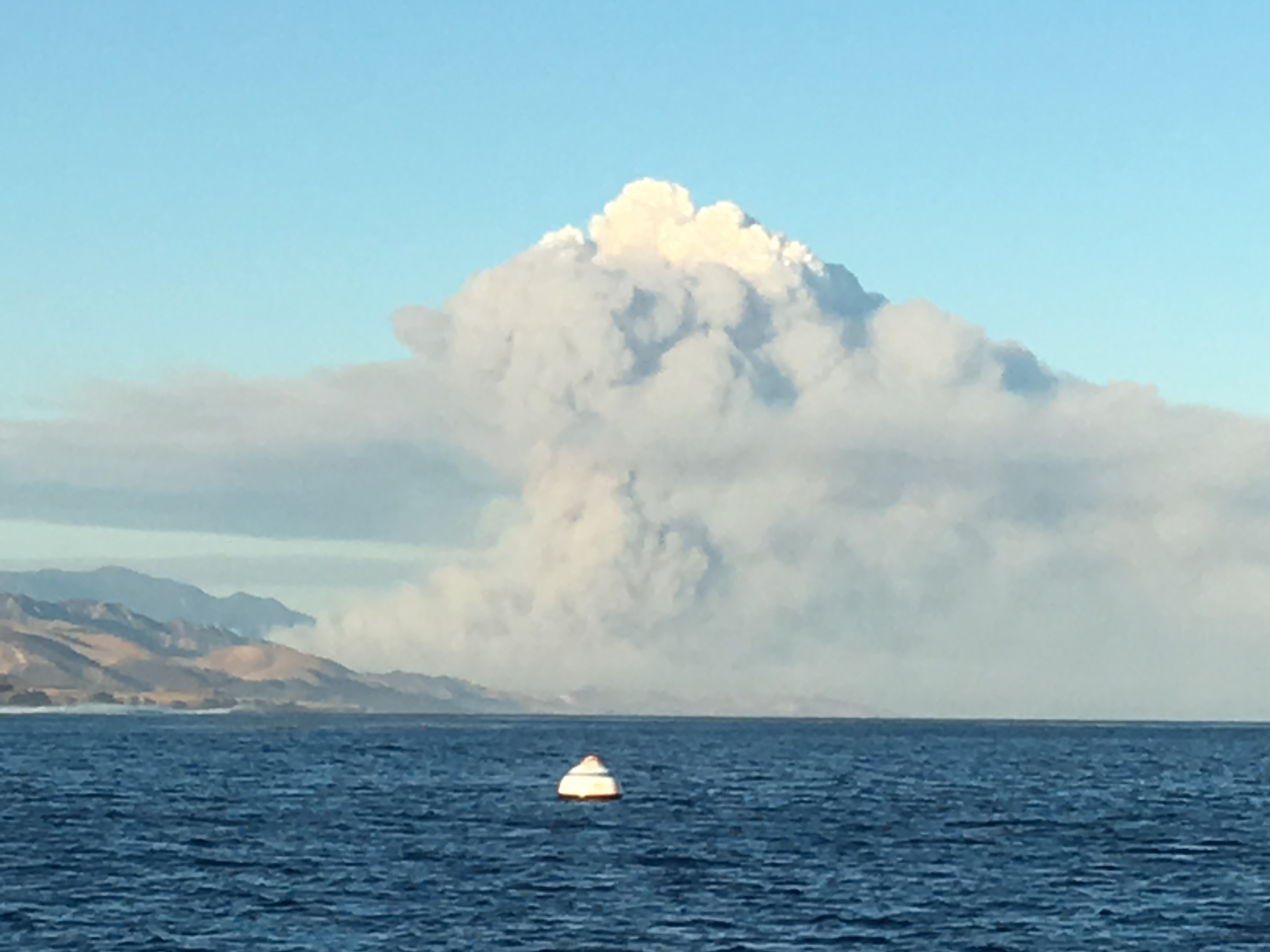
A good day for ducks at the Carmel River Lagoon

A mandatory evacuation has been ordered for all low-lying areas of Carmel Valley, as the Carmel River continues to rise toward a projected peak of 10.4 feet at the Robles del Rio gauge.

Here is the message from the Monterey County Office of Emergency Services:

A mandatory evacuation order has been given for residents who may be affected by flooding on the Carmel River.

The Carmel River is expected to hit flood stage beginning at 4 pm today and peak beginning at 8 pm tonight. Those affected are asked to leave as quickly as feasible. Areas that may be impacted by flooding include all low-lying areas adjacent to the entire stem of the river from the Los Padres Dam to Mission Fields.

The Red Cross has established an evacuation center at Carmel Middle School, 4389 Carmel Valley Road. The SPCA of Monterey County will be on hand to assist evacuees with their companion animals, please call the SPCA if you have large animals that need to be removed 831-373-2631.

Call 211 or text 898-211 “windstorm” for additional information.

As of 3:45 pm, the river was at 8.15 feet (5,600 cubic feet per second) at the Robles del Rio gauge.

Minor flood stage begins at 8.5 feet (revised down from 9 feet when minor flooding began along Paso Hondo at less than 9 feet last month). River systems are dynamic and rapidly changing during times of high water, making it impossible to predict exactly what will flood, or how deeply, at any given water level. This uncertainty is undoubtedly why such an extensive evacuation has been ordered.

The Carmel River reached 9.1 feet on January 11.

View the Robles del Rio gauge here.

5:30 pm Update: As of 5:00 pm, the Carmel River had actually gone down a little at the Robles del Rio gauge, measuring 8.06 feet (5,450 cfs), but heavy rain has begun moving into the area and, if it continues, this decline may be short-lived.

7:45 pm Update: As of 7:15 pm, the Carmel River had dropped to 7.73 feet (4,880 cfs), but it looks like it may have bottomed out and begun to climb again.

8:45 pm  Update: The Carmel River is officially on the rise again. 7.93 feet (5,230 cfs) as of 8:15 pm at Robles del Rio.

10:00 pm Update: At 8.54 feet, as of 9:45 pm, the Carmel River has now reached minor flood stage. It is flowing through Robles del Rio at about 6,300 cfs. The Hydrologic Prediction people have bumped the projected peak up to 10.8 feet. Hopefully, the river will peak below that level.

10:30 pm Update: As of 10:15 pm, the Carmel River was nearly back to its January high water mark. 9.0 feet at Robles del Rio (7,180 cfs).

11:00 pm Update: As of 10:45, the Carmel River was at 9.39 feet (8,030 cfs). This is the highest flow the Carmel River has seen since 1998, but still only about half the flow of the disastrous 16,000 cfs flood of 1995.

Midnight Update: As of 11:45, the river was up to 9.96 feet (9,370 cfs) at Robles del Rio. The good news is that the height of the water flowing over the spillway at Los Padres Dam appears to have leveled off, meaning the peak flow is probably passing, or has just passed, that location. Those near the river who have not evacuated should continue to carefully monitor the river and the upstream gauges.

5:30 am Update: The Carmel River peaked at around 10 feet on the Robles del Rio gauge, shortly after midnight – failing to reach the predicted 10.8 feet. As of 4:45 am it had slipped below flood stage to 8.44 feet (6,120 cfs). The peak, which has swollen to around 15,900 cfs as it has travelled downstream  is only now reaching the mouth of Carmel Valley.

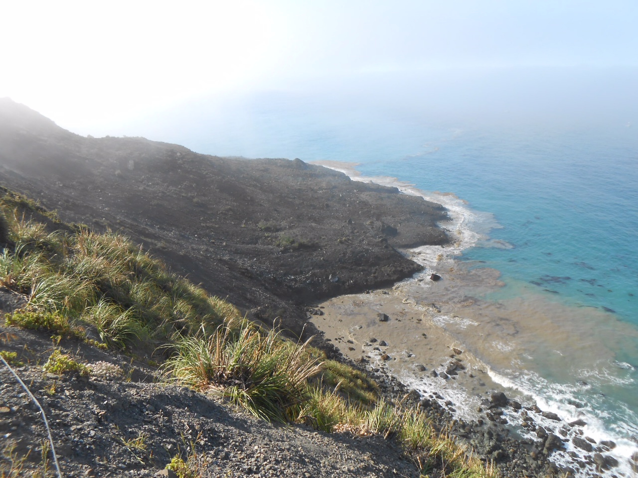
8:00 am Update: The peak has now passed out to sea and all parts of the river are going down. As of 6:45 am, the Robles del Rio gauge was showing 8.06 feet (5,450 cfs) and, as of 6:30 am, the Near Carmel gauge was showing 14,100 cfs.

Here’s what the river mouth looked like an hour ago:


Big Sur River Above Flood Stage for Fifth Time This Year

February 20, 2017

img_4806

South Coast oaks in the rain

Heavy pre-dawn rain has pushed the Big Sur River above the 10-foot level that marks its official “flood stage” for the fifth time in less than two months.

As of 9:00 am, the river was at 10.30 feet, which indicates a flow of 3,530 cubic feet per second.

On January 12, the Big Sur River hit 12.34 feet (or 7,650 cfs – more than twice the current flow); the second highest peak recorded since the gauge was installed. The highest was an amazing 10,700 cfs, recorded in January 1978, following the Marble Cone Fire.

This morning’s rain can’t be helping the situation at Pfeiffer Gulch, where a slide has been slowly pulling down the Highway bridge. Interestingly, when the bridge was built in the 1960’s, Caltrans erroneously signed it as the Pfeiffer Canyon Bridge and, taking their cue from the sign on the collapsing bridge, everyone now seems to be referring to the place as Pfeiffer Canyon.

It’s not the first time this ravine has undergone a name change or, apparently, had bridge trouble. According to Clark’s Monterey County Place Names, the Pfeiffers themselves knew the place as Burnt Bridge Creek.

See the Big Sur River Gauge here.

Noon Update: As of 11:45 the Big Sur River was still rising and had reached 10.85 feet, or 4,370 cfs.

1:00 pm Update: As of 12:45, the Big Sur River had reached 11.07 feet (4,730 cfs). The Carmel River is also rising and is projected to crest more than a foot above its January high water mark. If this happens, there will almost certainly be some flood damage.

2:00 pm Update: The Big Sur River has been level at 11.10 feet (4,790 cfs) for the past half hour. Rain is expected to become more intense this evening, so another rise will be possible tonight.

5:30 pm Update: As of 5:15 pm, the Big Sur River had receded to 10.3 feet (3,530 cfs); which is still above flood stage. Rain is beginning to pick up again over the Big Sur watershed and, if that continues, the river may begin rising again soon.

7:00 pm Update: Hard rain is falling and the Big Sur River is on the rise again. 10.40 feet (3,680 cfs) as of 6:30 pm.

9:00 pm Update: The Big Sur River is rising quickly and has surpassed this afternoon’s peak. As of 8:45 it was at 11.78 feet (5,960 cfs).

10:00 pm Update: Has the Big Sur River found its peak? It made it to around 12.22 feet, just shy of last month’s high water mark of 12.34 feet (the 2nd highest peak ever recorded), but has now (as of 9:45 pm) dropped back to 11.97 feet (6,310 cfs).

11:30 pm Update: The Big Sur River is rising again and, as of 11:15 pm, was back to 12.13 feet (6,570 cfs).

Midnight Update: That rise was short-lived. The Big Sur River is back under 12 feet and falling. Unless unexpectedly heavy rains arrive, it should continue to fall throughout the night.

12:30 pm 2-21-17 Update: The Big Sur River finally went back below flood stage around 11:00 this morning. Its twin peaks last night may have been a bit lower than the January high water mark, but the fact that it remained above flood stage for more than 24 hours is probably some kind of record.

As of 11:45 am, it was at 9.9 feet (2,940 cfs).