Soberanes Fire: Week Two

July 29, 2016

For more recent updates, see Soberanes Fire: Week Three and Soberanes Fire: Week Four

IMG_2676

For earlier maps and notes see Soberanes Fire: Week One

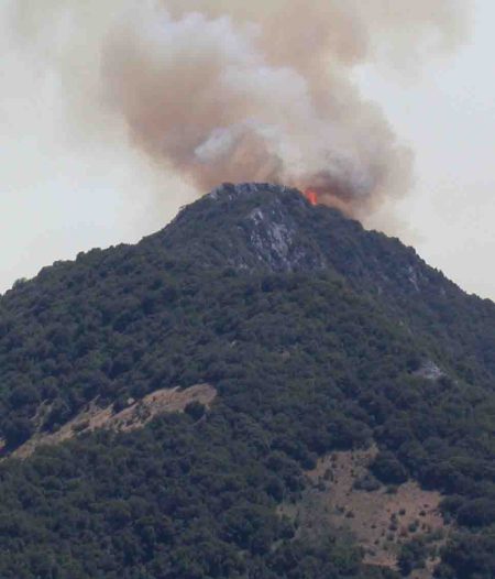
Important caveats: Please note that the squares on the heat detection maps represent the expected margin of error, not the size of the area burned. In other words, the detection could have come from anywhere within the square. Also be aware that false detections do sometimes occur. An outlying or “over the line” heat detection is not, by itself, a confirmation that there is fire in the area indicated. In addition, the satellites do not detect heat everywhere that fire exists. Creeping, backing or smoldering fire is often not detected. Finally, the detections are only snapshots of moments in time. Flare ups that occur before or after a satellite pass may be entirely missed.

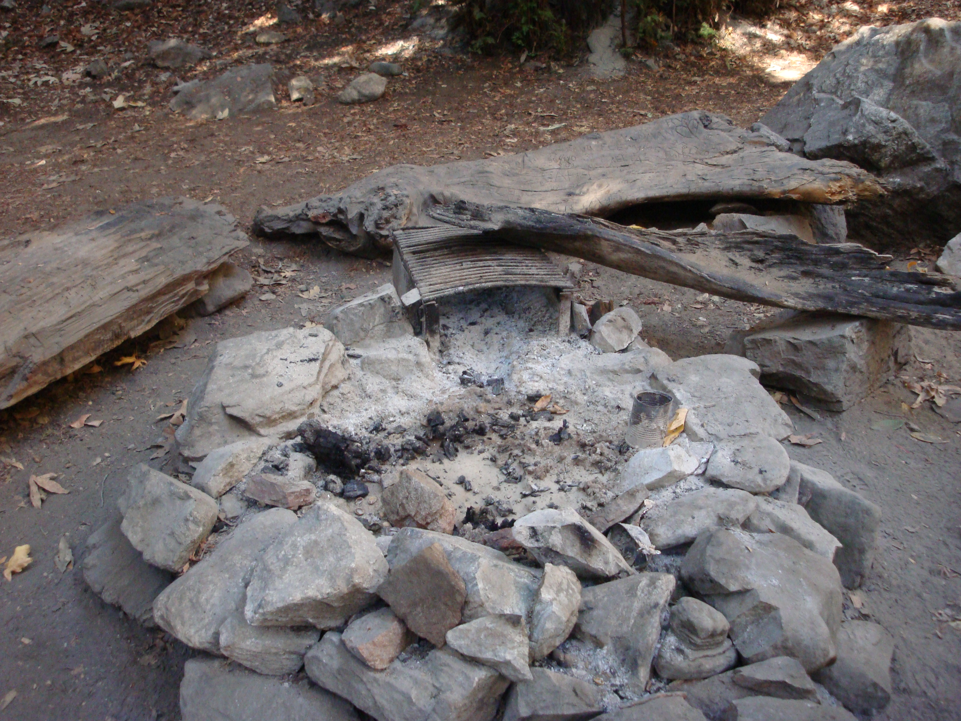
Also be aware that yellow squares disappear from the map after 6 days. These are not maps of the area burned since the fire began, just maps of where heat has been detected during the past week. Read the rest of this entry »


Soberanes Fire: Week One

July 22, 2016

For more recent updates, please see Soberanes Fire: Week Two,  Soberanes Fire: Week Three and Soberanes Fire: Week Four

Thursday 7-28-16 8:00 pm Update:

7-28pm

Lots of smoke coming from the fire today and there’s no doubt about where most of it was coming from… Read the rest of this entry »


The Campfire Conundrum

June 30, 2016

DSC09939

On a Sunday walk along the Pine Ridge Trail during Level IV fire restrictions in 2013, we looked at dozens of fire rings and couldn’t find a single one that hadn’t been used the night before. Read the rest of this entry »


Fire Season

May 28, 2016

pico-flames

Pico Blanco crowned with fire. (Lloyd Jones photo)

The grass on the hills is turning brown, seasonal streams are disappearing, and swarms of face flies have emerged to launch their annual shock and awe campaign against backcountry travelers.

This can only mean fire season is upon us. As is traditional at the start of fire season, the media has begun warning that this fire season is expected to be especially bad – maybe the worst ever. In wet years, this prediction is based on the grass being high. In dry years, on the simple fact that things are dry.

In reality, no one really knows what kind of fire season we’ll have. This is because the amount of rain we do or don’t receive in the preceding rainy season is less important than the kind of weather we get in the summer. In years when there are a lot of warm, windy days with low humidity (which is another way of saying days when offshore flow pushes the marine layer out to sea), there are likely to be more, and worse, fires. Fires simply ignite more easily in these conditions and, once they ignite, spread much more quickly.

It’s also worth remembering that the three largest fires to burn in Monterey County over the past 50 years (Marble Cone, Kirk Complex and Basin Complex) were started by dry lightning. Dry lightning storms are relatively rare in our area, but when they do occur they can overwhelm firefighting resources by starting hundreds of fires at once. Obviously, there is no way to predict whether such an event will happen in any given year.

As vividly demonstrated by the December 2013, Pfeiffer Ridge Fire, fire danger isn’t even limited to fire season. Given the right conditions, serious fires can occur at any time of year.

So how about this year and every year we all just make damn sure we don’t let our catalytic converters, tow chains, weed whackers, wood stoves, electrical wiring, guns, etc. start any fires and, meanwhile, make our homes as fire resistant and defensible as reasonably possible?


More Water Needed in South County Reservoirs

March 15, 2016

IMG_0714

High water doesn’t last long on the volatile Nacimiento River

News of reservoirs reaching capacity has been coming in from around Northern and Central California this week but, for the Salinas Valley, water remains a problem.

As of this morning, the San Antonio Reservoir holds a measly 18,875 acre feet of water. That’s just 6% of capacity and more than 4,000 acre feet less than what’s considered to be its “minimum pool.” Since the lake hit its all-time low of 10,254 acre feet at the beginning of the year, El Niño rains have added less than 9,000 acre feet to storage. And there isn’t a lot of rainy season left. Read the rest of this entry »


The Sorry State of Water Conservation on the Monterey Peninsula

February 5, 2016

For years local officials have waived off suggestions that the Monterey Peninsula could do more to save water by falsely claiming that “residents of the Monterey Peninsula use less water per person per day than anywhere else in the state.” They’ve even gone so far as to publish fraudulent figures purporting to support this claim.

The purpose of this grandiose bragging has been to promote approval of as large and growth-inducing a new water project, whether dam or desal, as possible. That effort appears to have succeeded, but at the cost of undercutting efforts to increase water conservation. Read the rest of this entry »


November Surf in December

December 11, 2015

IMG_0174

A swell that peaked at 30 feet last night combined with a 6.5 foot high tide to bring ground-shaking waves ashore on Carmel Point this morning. Read the rest of this entry »


Up Against the Wall: Steelhead and the Carmel Lagoon Ecosystem Protective Barrier

February 9, 2015

Reeds

The Carmel River Lagoon in 1947 (Laidlaw Williams photo)

There’s been some uproar lately over the plan to build a flood barrier in the Carmel River Lagoon and people have been asking on social media and elsewhere why anyone would propose to place such an assumed-to-be-ugly wall along the northern margin of such a beautiful wetland. A better question may be whether we can find a way to live our lives that doesn’t prevent steelhead from living at all. Either way, it’s a long story… Read the rest of this entry »


Will 2015 be Another 2013, or is January Just Not Part of the Rainy Season Anymore?

January 16, 2015

IMG_2175

As the flow of the Carmel River becomes too weak to resist the power of the sea, waves rebuild the sandbar.

Remember how in we got a lot of rain in the fall of 2012? Monterey logged 9.59 inches for November and December that year. The average for those two months is only 5.41 inches. Read the rest of this entry »


Carmel River Reaches the Sea for First Time in Almost Two Years

December 13, 2014

IMG_2036

The slowly rising lagoon reached the top of the bar shortly before sunrise this morning. Read the rest of this entry »