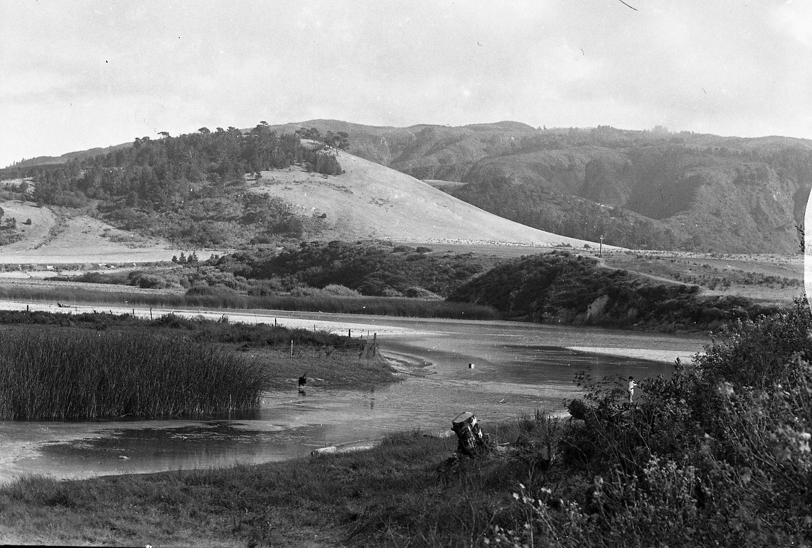
The Carmel River Lagoon in 1947 (Laidlaw Williams photo)
There’s been some uproar lately over the plan to build a flood barrier in the Carmel River Lagoon and people have been asking on social media and elsewhere why anyone would propose to place such an assumed-to-be-ugly wall along the northern margin of such a beautiful wetland. A better question may be whether we can find a way to live our lives that doesn’t prevent steelhead from living at all. Either way, it’s a long story…
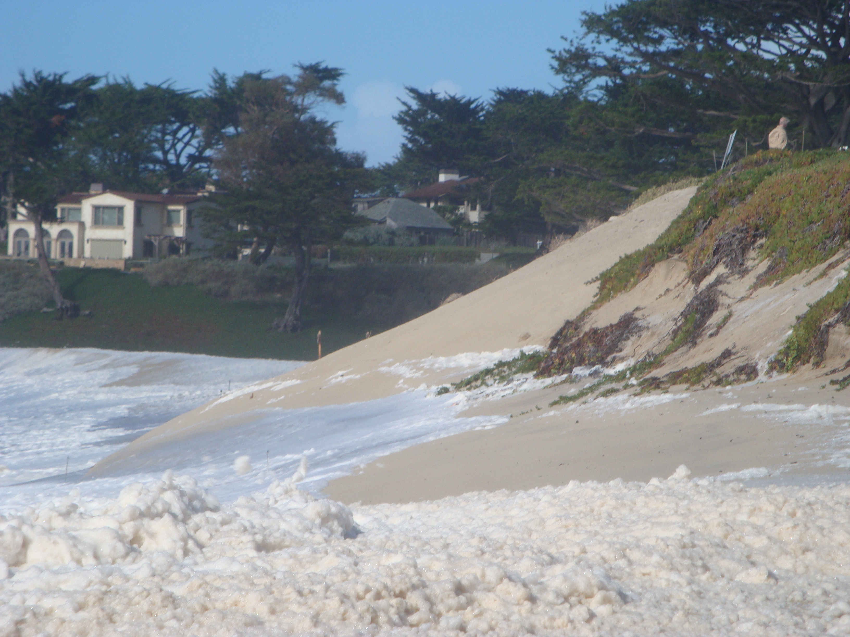
Once upon a time, as the rainy season began, the Carmel River Lagoon would back up against the high sandbar at its mouth and spread out across many acres of rich marshland. Steelhead smolts, moving downstream from the cold, high altitude tributaries where they spend their formative years, would arrive in the rising, food-rich lagoon and begin a period of rapid growth. They would also undergo physiological changes that would prepare them to survive in salt water.
Wind and wave action tend to make the sandbar lowest at its northern end and, when the lagoon finally reached the top, it often flowed off to the north, through the back-beach swale at the base of the dunes. This indirect route to the sea prevented rapid draining of the lagoon. The smolts had all the time they needed to grow and prepare for their new life in the sea. Meanwhile, as many as 20,000 adult steelhead would cross the bar in the other direction, and begin their journey upstream to spawn.
But dam building, beginning in the 1880s, cut the steelhead off from most of their spawning grounds and cold-water tributaries. Their numbers began to plummet.
The lagoon too began to shrink, as surrounding property owners “reclaimed” it by filling it in for use as pasture and farmland. But those on the north side of the lagoon didn’t pile their fill high enough to keep their newly reclaimed land out of the flood zone. Sometime in the 1930s, if not earlier, they began working with shovels to breach the sandbar and keep the water off their land. I’ve seen a photo purported to be from 1900 depicting a team of horses engaged in excavating a trench, but what would they have been trying to protect in 1900?
In any case, whether by hand or horse, digging a trench through sand is hard work. Naturally, they dug the most direct route to the sea; and the result was often catastrophic draining of the lagoon. Any smolts that weren’t swept to a likely death at sea were left in a smaller, shallower lagoon where they were much less likely to find enough food to support their growth and were much more likely to be picked off by pelicans and other predators.
And still the land flooded. It simply wasn’t always possible to move that much sand in time – assuming the waves would even allow work to proceed. Overtopping by waves, the property owners soon learned, could raise the lagoon level rapidly with little warning; and it was something they were powerless to prevent.

The Lagoon in the 1940s with the low lying fill still undeveloped (Laidlaw Williams photo)
In spite of this, the land was subdivided and sold as residential lots in the 1950s. When the new homeowners saw the water lapping at their doors, they demanded that State Parks (the beach is a State Beach managed by State Parks) do something about it; specifically, they demanded that my Dad, who was a State Parks Naturalist at the time, get out of bed at 2:00 am and head out to the sandbar with a shovel.
In 1973, Monterey County, which had approved the lagoon-bottom construction in the first place, finally took over responsibility for breaching the lagoon. But even with their bulldozers they couldn’t always guarantee success – and they still can’t. Periodic floods continue to this day.
Meanwhile, the steelhead continued to dwindle and, when massive Cal-Am pumping combined with drought in the 1980s to dewater the lower river and prevent migration, it looked like the steelhead were finished. In 1992, just 15 returning steelhead were counted at the San Clemente Dam.
The County, which was now regularly breaching the sandbar, had never sought any of the required state or federal permits, pretending instead that each upward fluctuation in water level was an unforeseeable emergency exempt from permit requirements.
In February 1992, however, with the steelhead knocking on the door of oblivion, the County received a letter from the Army Corps of Engineers informing them that sandbar breaching could not be considered an emergency action, due to the fact that flooding of the lagoon-bottom homes was utterly predictable and that the breaching was, in fact, an ongoing lagoon management program, rather than a series of unrelated emergencies. They demanded that the County stop breaching without a permit.
The County quickly applied for a permit, but did more or less nothing to move the process forward. And they continued to breach the sandbar without a permit.
Meanwhile, against all odds and thanks mainly to the relentless efforts of a few hard working members of the Carmel River Steelhead Association, the small, remnant steelhead population continued to survive.
Since then, the timeline looks something like this:
1993
The County breaches the center of the sandbar, but the cut migrates to the north and the river eventually turns into its preferred route along the bottom of the dune supporting Scenic Road. Scenic Road residents and the County worry that the road will be undercut. Although the northward cut is ideal for the steelhead, the County creates a new cut further south and blocks off the flow to the north.
1997
The National Marine Fisheries Service lists Central Coast steelhead as threatened under the Endangered Species Act. This means permits for sandbar breaching, which the County still hasn’t obtained, are now going to be a lot harder to get. Illegal bulldozing continues.
1999
The County files a new application and begins preparing an “Interim Lagoon Management Plan” in hopes of receiving permission to continue breaching the sandbar until an unspecified permanent solution to the problem can be found. The sandbar is illegally bulldozed a record eight times during the 1999 water year.
2000
The Army Corps of Engineers issues a letter advising the County that their continued bulldozing is unauthorized and illegal. Illegal bulldozing continues.
2001
The County finally submits a Biological Assessment in support of their 1999 permit application. The National Marine Fisheries Service examines the Assessment and rejects it as not representing “the best scientifically available information.” Illegal bulldozing continues.
2003
The Army Corps of Engineers issues a letter formally notifying the County that their Biological Assessment is inadequate. Realizing that National Marine Fisheries and the Corps aren’t going to approve an “interim” sandbar bulldozing plan without a permanent solution identified and on track for implementation, the County begins talking seriously about building some sort of wall or barrier between the lagoon and the flood-prone homes. The idea is that with the homes safely behind a water-tight barrier, mechanized breaching will no longer be necessary. The lagoon can be left to rise, fall, and breach its sandbar, naturally.
Reaction among lagoon-bottom residents is mixed. Some reject the idea out of hand and imperiously demand that regular bulldozing continue indefinitely. Others think the idea is worth considering. Some people outside the neighborhood object to tax money being spent to save people from their own folly and wonder why residents don’t simply raise their houses above flood level or move away. Illegal bulldozing continues.
2005
The National Marine Fisheries Service suggests that bulldozing an angled outlet channel at the north end of the beach, to mimic the natural outlet channel, might result in slower drawdown and less steelhead mortality. The County tries it and, as hoped, it results in slower draining and a larger remnant lagoon. Some Scenic Road residents object that the road is being endangered. The County shares their concern. A Carmel River Lagoon Technical Advisory Committee is formed to develop better, more environmentally sensitive, breaching strategies. Meanwhile, the river and lagoon are formally designated as steelhead critical habitat, underscoring the seriousness of continued unpermitted breaching. Illegal bulldozing continues.
2008
Fourteen homes flood as high surf fills the lagoon and prevents mechanized breaching. Eventually the sandbar breaches on its own. This is the only time the first breaching of the season has occurred naturally since record keeping began.
2009

October 14, 2009: In spite of the fact that a major rain event had been predicted for more than a week, the county waits until a nearly 5,000 cubic feet per second (cfs) flow is headed down the river – then forgets all about making an angled cut and simply chops straight through the middle of the bar. Rapid draining results.

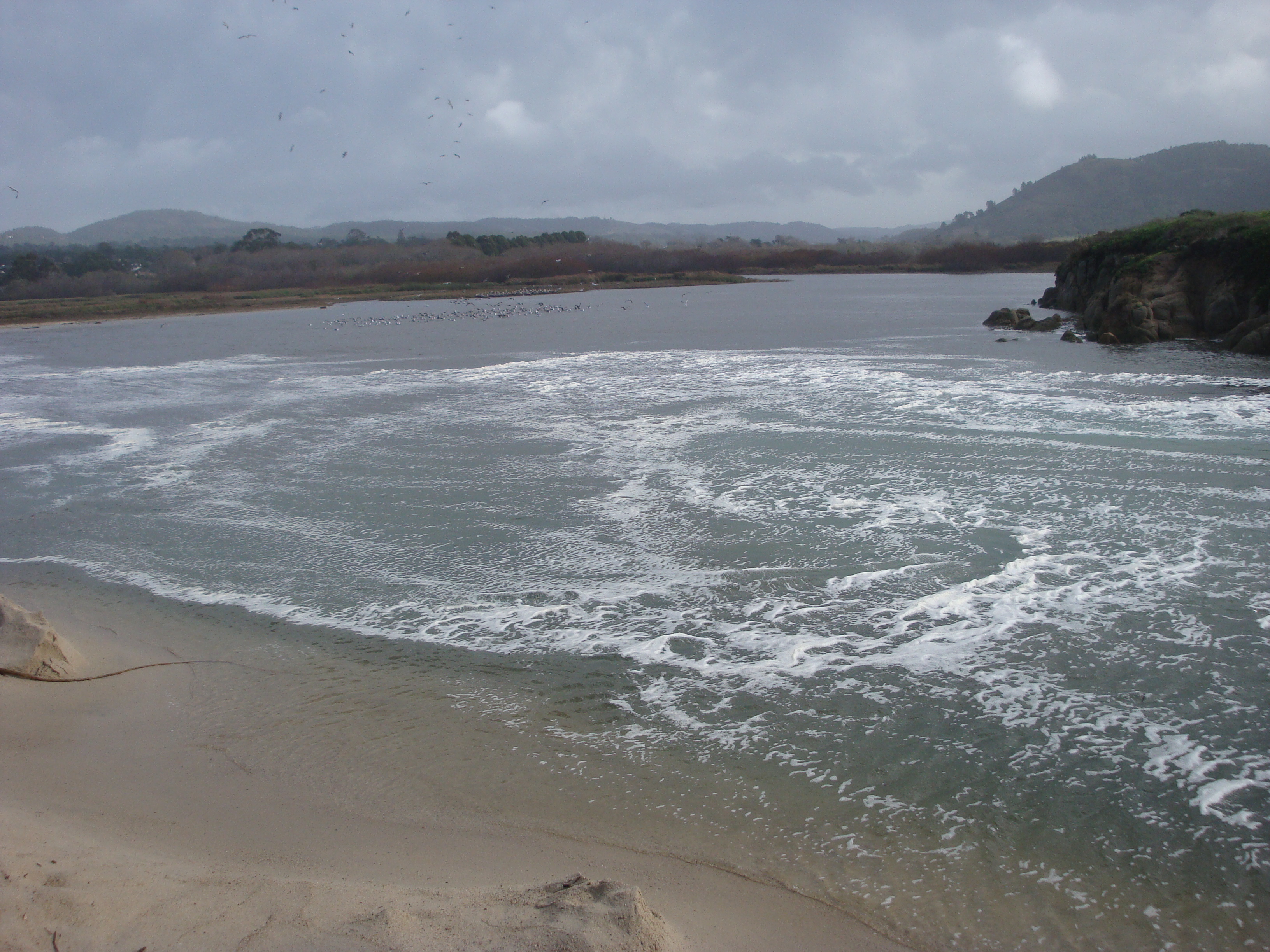
October 25, 2009: Conditions can change quickly at the lagoon. Nine days later, waves have restored the bar, the river is refilling the lagoon, and people are enjoying the sunshine.
November 7, 2009: The dozers are called out again due to heavy surf overtopping the bar and bringing the lagoon close to flood stage. Waves replace the sand nearly as fast as the dozers can move it. They don’t succeed in creating a lasting breach.

A truck delivers sandbags to the endangered neighborhood, while the dozers battle waves on the bar.

November 22, 2009: Not all unnatural breaches are caused by the County. When the lagoon level gets close to the top of the sandbar, some people find the temptation to create a breach irresistible.
Fortunately for the steelhead, it’s tougher than it looks. Few without shovels succeed.

December 12, 2009: Some gentle rain and a high tide? Call out the dozers! This time they make a cut toward the southern end of the beach.
December 14, 2009: In theory, an angled southern cut is supposed to be better than a center cut, but this one doesn’t work out that way. The lagoon drains completely. Nothing is left but the river flowing straight on through to the sea. A disaster for any smolt not yet ready for life in the ocean.

December 28, 2009: Waves have rebuilt the bar and the lagoon is rising. The height of the bar is surveyed to determine whether it must be breached.

Unsurprisingly, the decision is to make the cut.

December 29, 2009: Not wanting to repeat the complete dewatering of the lagoon, the County dams off the outflow after the water level falls.
2010
The County makes a new application to the Army Corps of Engineers for a permit to manage the sandbar. Frequent illegal bulldozing continues…

By January 9, 2010 the lagoon has gotten rather full again.
January 10, 2010: The surf begins to build.

January 12, 2010: Waves are overtopping the bar. Three dozers work on an oblique cut to the south; the fifth illegal breaching since October.

January 13, 2010: The angled cut quickly fails and the river is soon pushing straight out to sea again.
January 18, 2010: Waves rebuild the bar and begin filling the lagoon.
January 19, 2010: The surf gets bigger.

January 20, 2010: Here it comes…

Waves sweep the beach parking lot.
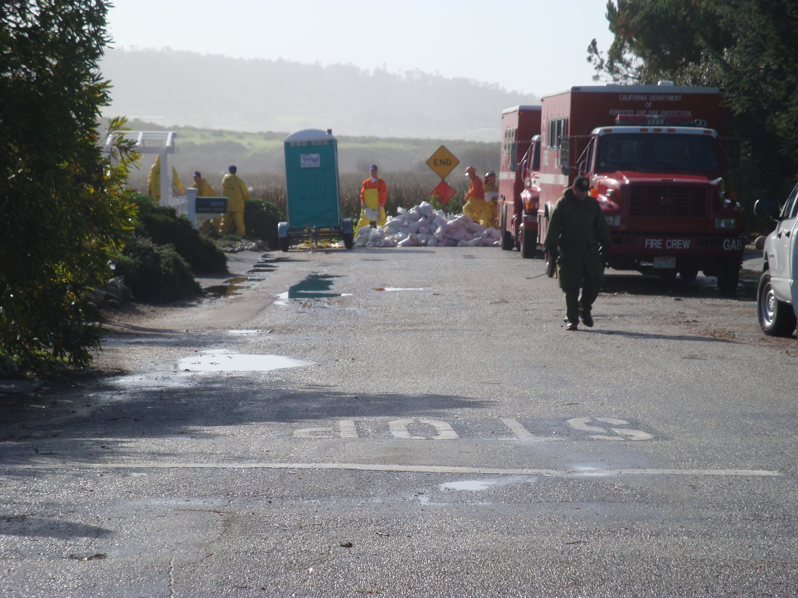
Crews pile sandbags and prepare to battle floodwater in the lagoon-bottom neighborhood.
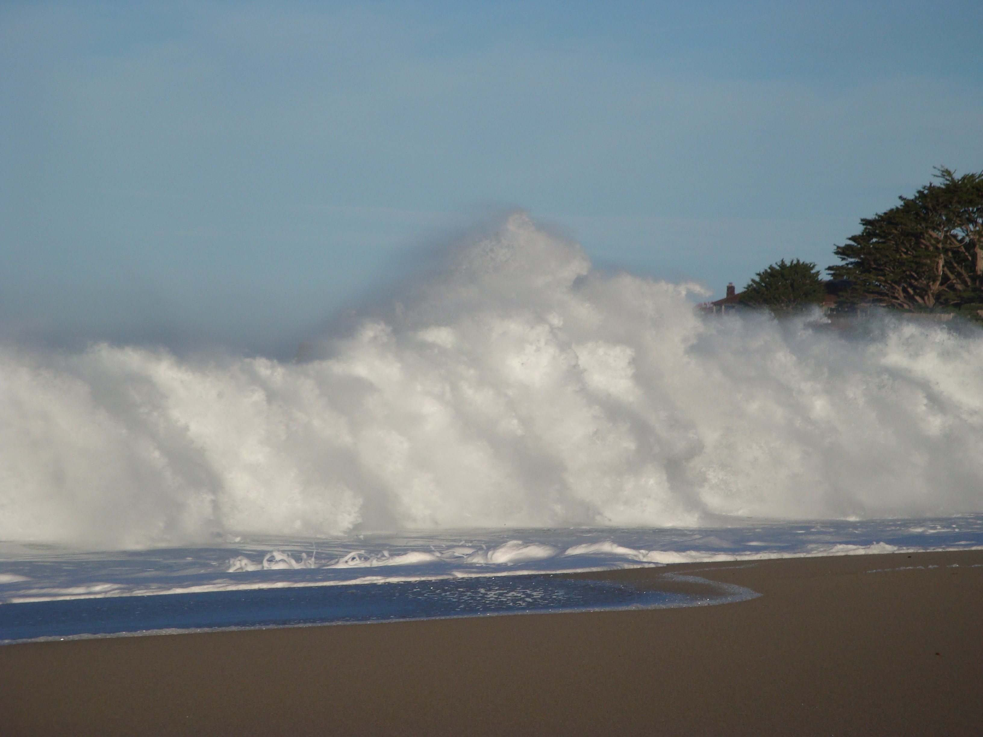
Waves directly attack the dune supporting Scenic Road; demonstrating beyond any doubt that it is the ocean, rather than the river, that poses the greatest threat to the homes and infrastructure perched there.
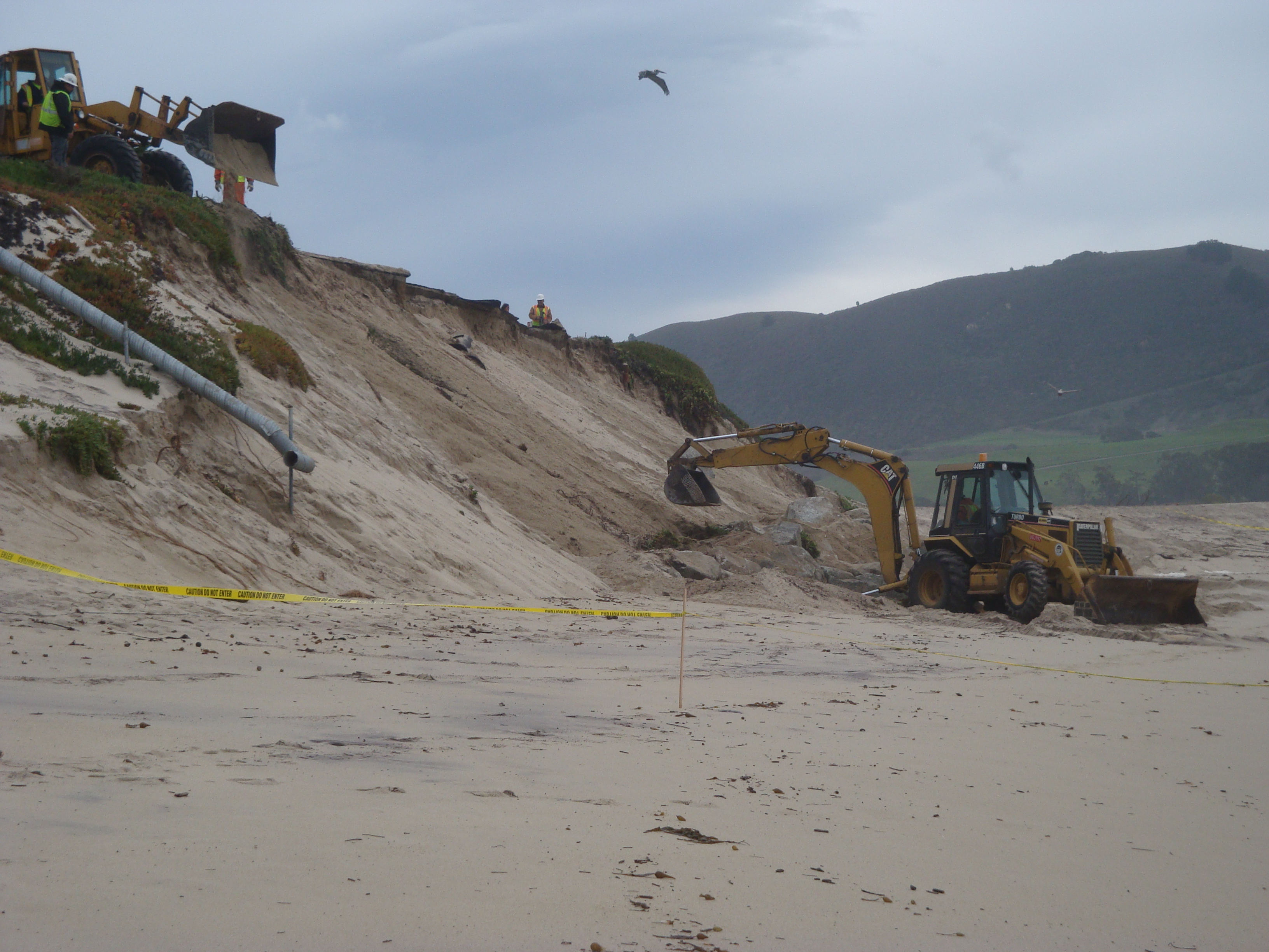
January 25, 2010: County crews work to stabilize the undermined dune.
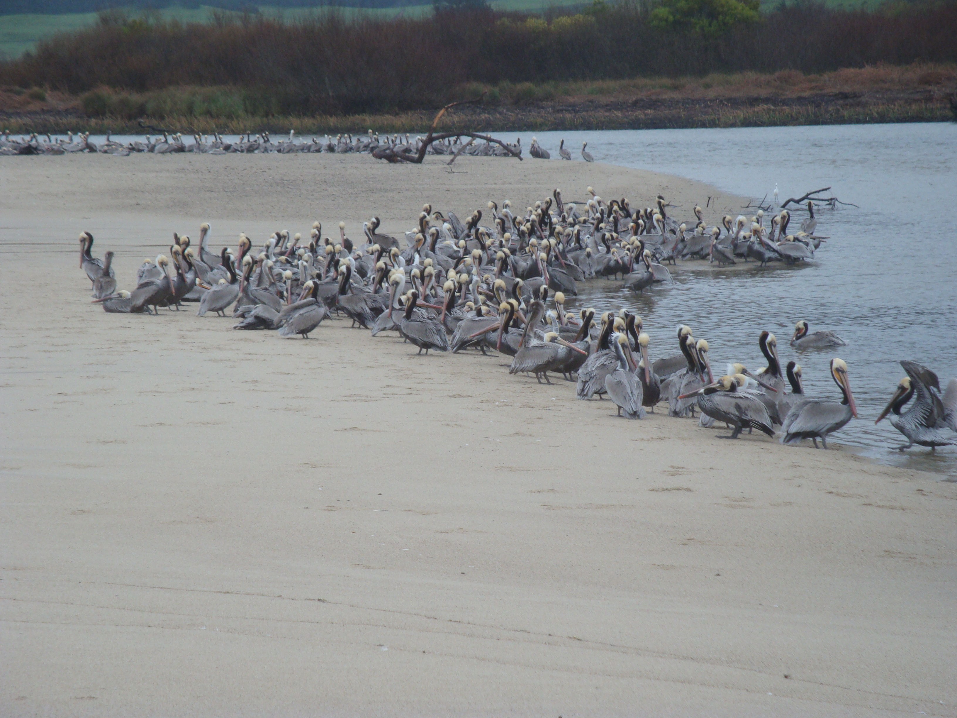
January 26, 2010: With the lagoon nearly dewatered again, Pelicans flock to eat the fish.
October 2010
The Carmel River Steelhead Association finally loses patience and files a Notice of Intent to Sue over the County’s ongoing violations of the Endangered Species Act.
November 2010
The National Marine Fisheries Service agrees to help the county find alternatives to mechanical breaching and “encourages” the County to comply with federal law by obtaining the necessary permits. The National Marine Fisheries Service and the Army Corps of Engineers inform the County that no emergency permits will be issued unless a long-term solution is developed. The County begs the Carmel River Steelhead Association not to sue, due to the progress they’re making with the federal agencies.

November 29, 2010: The County decides to prepare a cut in advance this time; and they decide to go back to the fish-friendly northward alignment.

But when waves start topping the bar on December 20, 2010, the cut they open doesn’t angle much.
December 26, 2010: Less than a week later, the waves rebuild the bar.
2011

March 20, 2011: A cut has been opened toward the north end of the beach and it’s migrating further north. Efforts to push it back to the south fail.

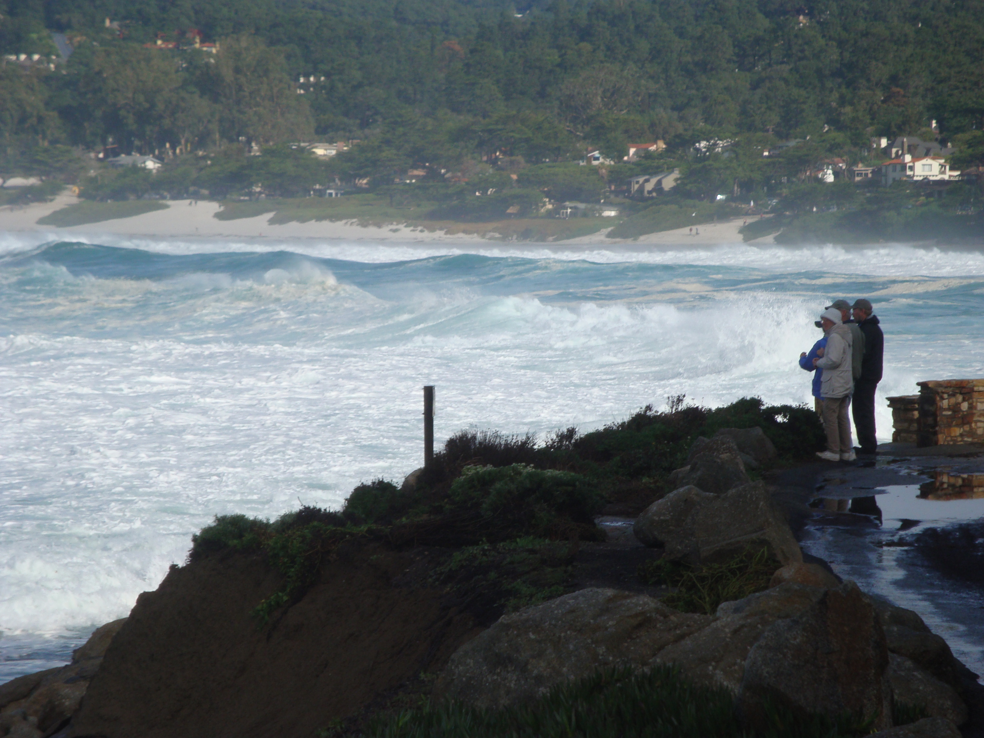
March 25, 2011: A peak flow of more than 7,000 cfs sweeps away a good portion of the parking lot. About 5,000 cfs was still chugging across the sandbar when this picture was taken. Some say this demonstrates the folly of allowing the lagoon to breach near its northern end. The County realizes that the State Park parking lot and restroom, as well as Scenic Road, will have to be protected, if the lagoon is going to be allowed to breach naturally toward the northern end of the bar.
September 2011
The National Marine Fisheries Service says that because no changes have been made to the proposed Interim Lagoon Management Plan since they rejected it in 2003, they intend to reject it again. The County sits down with the Corps and National Marine Fisheries to figure out what to do about this. They are told that the way forward is to eliminate the need for mechanical breaching by building a flood wall and armoring the dune supporting Scenic Road. The County is advised to withdraw their doomed application for Interim Lagoon Management and apply for a permit to build the permanent solution. The County submits a combined application for the flood wall, which they call the Ecosystem Protective Barrier (EPB), the dune armoring, which they call the Scenic Road Protection Structure (SRPS), and a five-year Interim Sandbar Management Plan, to allow them to legalize their bulldozing while they build the other things.
November 2011
The Army Corps of Engineers issues an “emergency authorization,” allowing continued bulldozing pursuant to the terms of the Interim Sandbar Management Plan, so long as the County abides by a Memorandum of Agreement that commits them to moving forward with the EPB and SRPS. The County’s 38 year old lagoon management program finally obtains some degree of legitimacy.
2013
The Army Corps of Engineers worries in writing that their long history of failing to enforce the law against the County’s repeated violations of multiple federal laws may result in liability.
2014

December 14, 2014: Abiding by the terms of the Interim Plan, County dozers lower the bar to a level just below flood elevation, then allow the lagoon to breach semi-naturally. Unfortunately, they do it at the south end of the beach, which results in fairly rapid draining. Due to the ongoing drought, this is the first time the Carmel River has flowed to the sea in nearly two years.

A sandbag barrier remains in place, just in case.
2015

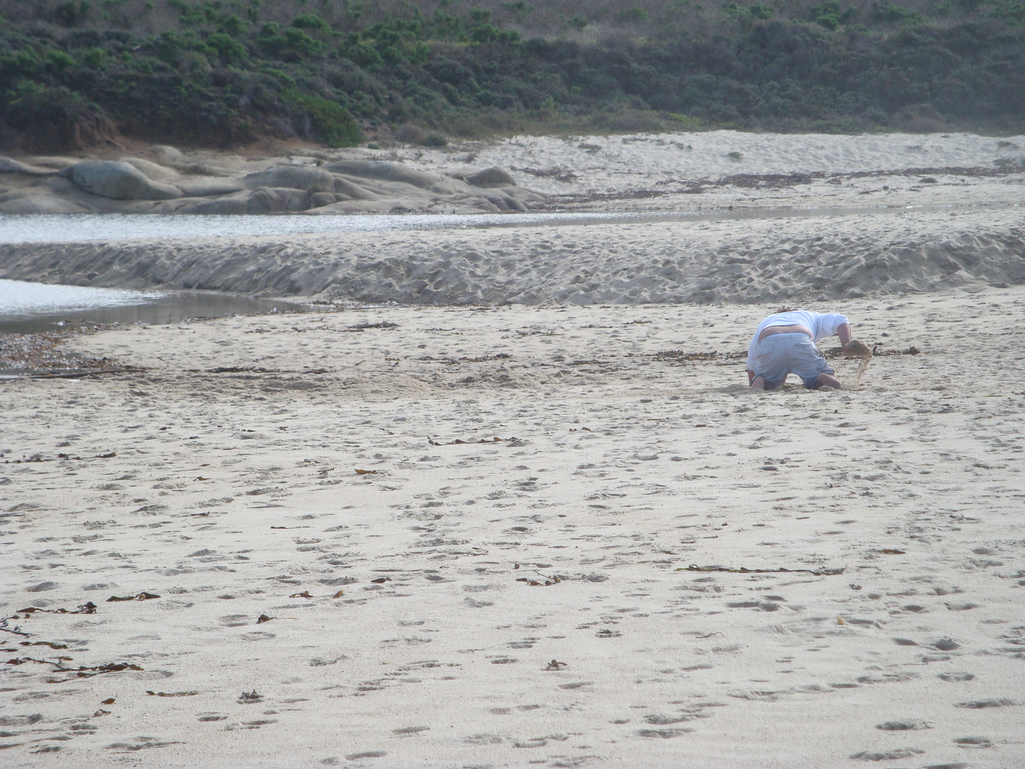
February 7, 2015: With the lagoon near the top of the sandbar again, a group of teens spend most of the day trying to create a breach. Word is they hope rapid draining will create a surfable standing wave. They don’t succeed, but they leave an impressive trench…

Which Fish & Game and State Parks employees have to fill in.

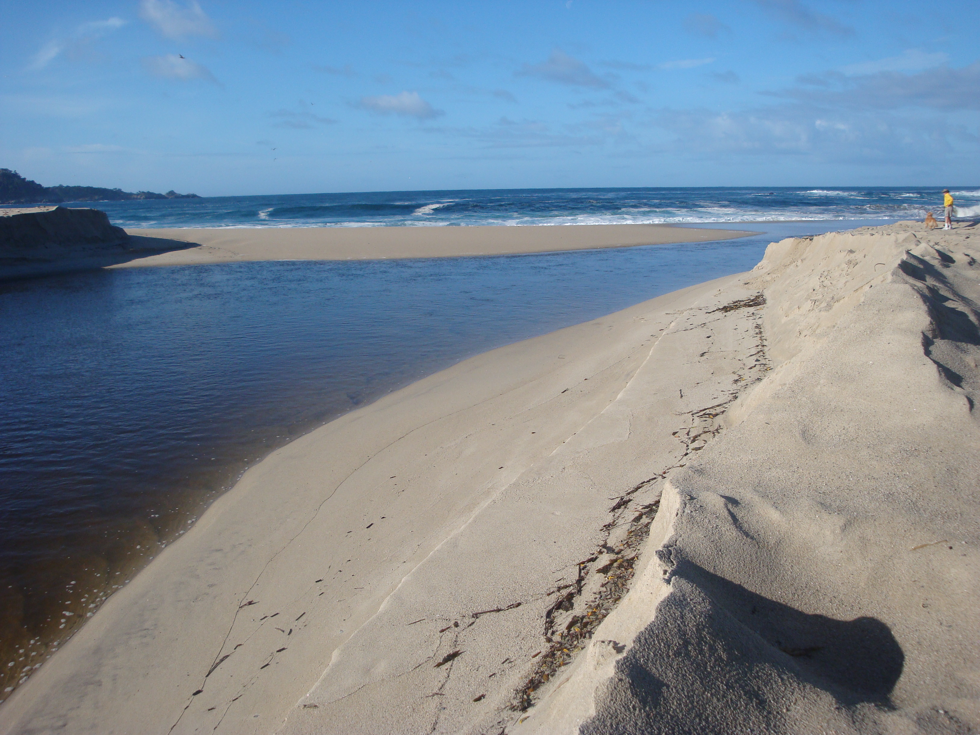
With the lagoon continuing to rise, the breach occurs around 10:30 the next morning. Don’t know if it had any help from the kids, but at that point it was about to go anyway.
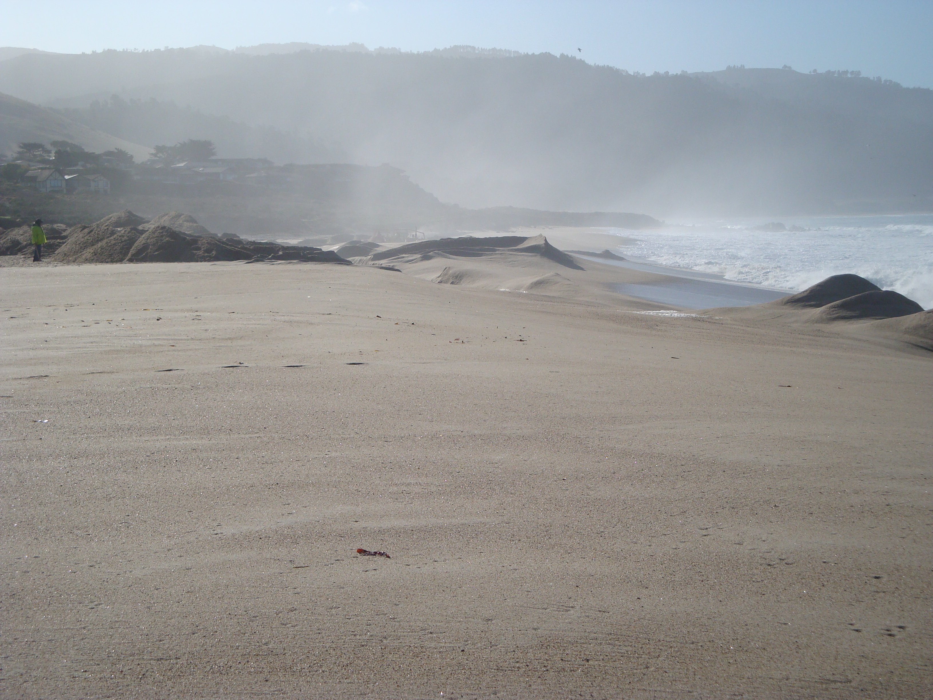
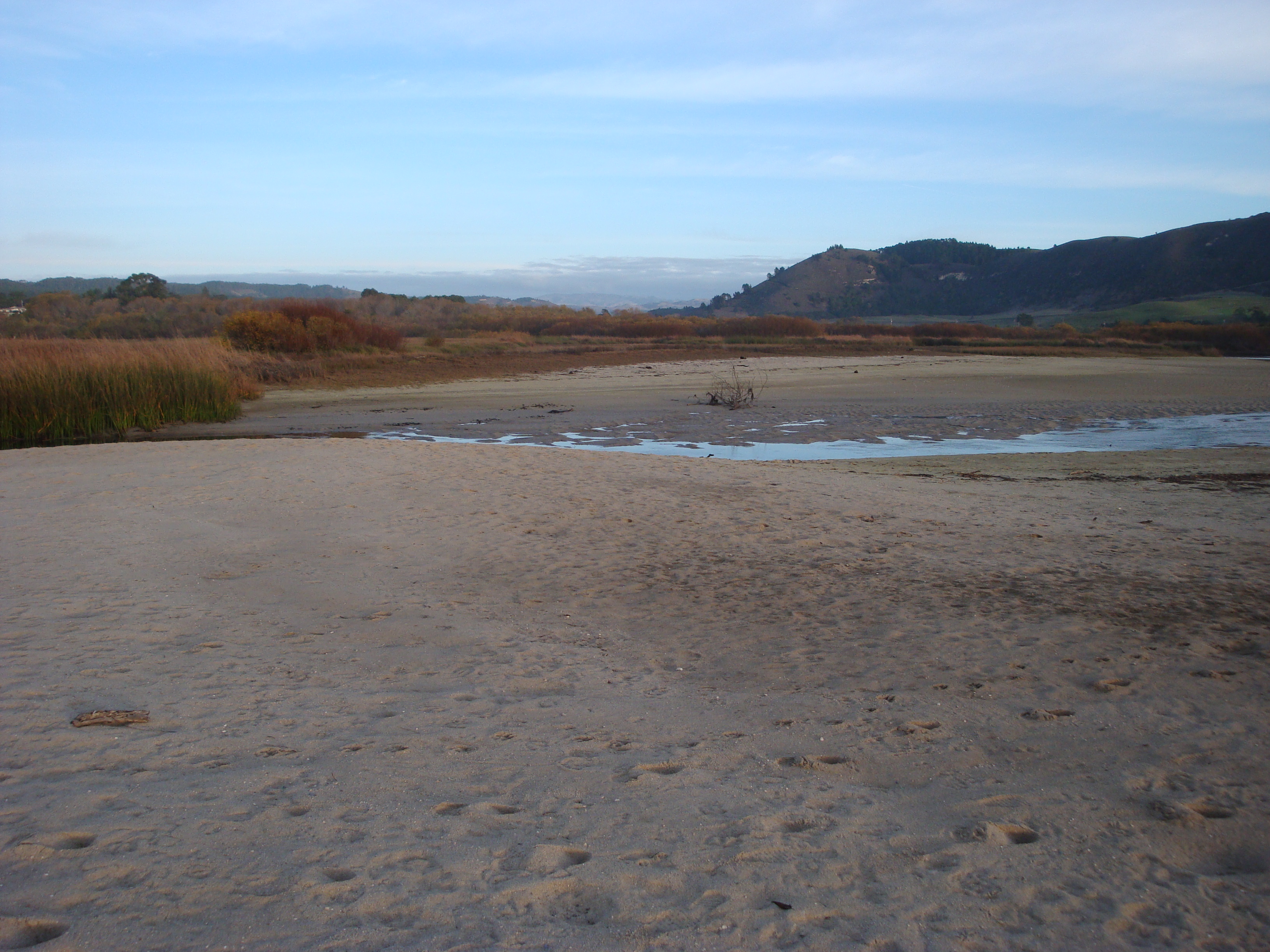
And that’s where things stand. People breach the sandbar to prevent flooding, to keep the river from undercutting roads and infrastructure, to create standing waves, for the simple thrill of it, and sometimes even because they mistakenly believe it will help the steelhead. Whatever the reasons, it happens a lot. And the steelhead continue to be hindered, rather than helped. The problem the project is designed to address, whether or not this project is the best solution, is real and ongoing. Let’s hope we can find a way to let the sandbar manage itself, while there are still some steelhead to benefit.
The Ecosystem Protective Barrier and Scenic Road Protection Structure undoubtedly face a long slog through the permitting process, with plenty of opportunities for public input lying ahead. To read up on the details of the project, view the snazzy maps, and learn more about the environmental values and infrastructure at stake, check out the County’s latest (2014) Biological Assessment.

This is an amazing description of the issue. Thank you.
Thank you for putting this together. Very descriptive and I liked all the photos of the breaching of the river. We must remember the Native American Archeological sites and traditional uses of the lagoon and the river that has been used for thousands of years by the Esselen and then the Rumsien Tribes.
Your excellent presentation helps me understand the complexities of this problem. Thank you!
Lisa Hoivik
Terrific summary.
Thanks, Keith.
We have the same disturbing problem with residents trenching to breach Corcoran Lagoon Beach here in Santa Cruz. Their worry is not real estate, however. They just want more beach.. for some to continue to illegally run their dogs off-leash. At least Santa Cruz County is not the main perpetrator, as with your dismal situation with Monterey County. Great photo-documented history. Maybe you could convince someone at CSUMB to monitor (with cameras) the beach.
Great strait forward perspective!
Great summary and timeline illustration of the issues at play. There is a tragic irony in this drama to which you only allude It is that the continued existence of the Scenic Road dunes is ultimately dependent on the river delivering it’s sand load to the nearshore environment of the north beach in order for waves use that sand to build the high and wide subsurface beach complex that causes giant swells to dissipate their energy well offshore before attacking the dunes. Sad irony.
The Monterey Peninsula Water Management District and Cal-Am recently agreed to co-fund several studies concerning Los Padres Dam, including a sediment management study. Any change at Los Padres Dam that would result in an increased sediment supply to the lower Carmel River and ultimately to the beach would take many years – if not decades to reach the beach; however, we need to begin the long, arduous process of evaluating options for this aging dam and coming up with sustainable solutions to address upstream fish passage, downstream habitat impacts, sediment starvation in the river channel, and consider the need for surface storage to augment flow in the dry season. This will be an important set of studies that may have long-term effects on the management of the river and lagoon.
A 60 day notice has and or should be sent to noaa, monterey county, DFW, state dept water resources, cal-am, and mpwmd.The ESA recognized bureaucratic resistance and corruption as problems and gave the public the right to act on the goverments behalf.