September 2, 2016
Important caveats: Please note that the squares on the heat detection maps represent the expected margin of error, not the size of the area burned. In other words, the detection could have come from anywhere within the square. Also be aware that false detections do sometimes occur. An outlying or “over the line” heat detection is not, by itself, a confirmation that there is fire in the area indicated. In addition, the satellites do not detect heat everywhere that fire exists. Creeping, backing or smoldering fire is often not detected. Finally, the detections are only snapshots of moments in time. Flare ups that occur before or after a satellite pass may be entirely missed.
Also be aware that yellow squares disappear from the map after 6 days. These are not maps of the area burned since the fire began, just maps of where heat has been detected during the past week. Read the rest of this entry »
 11 Comments |
  Big Sur, Carmel River, Fire, Flood & Apocalypse, History, Santa Lucias |
  Permalink
 Posted by xasauan
August 26, 2016
Important caveats: Please note that the squares on the heat detection maps represent the expected margin of error, not the size of the area burned. In other words, the detection could have come from anywhere within the square. Also be aware that false detections do sometimes occur. An outlying or “over the line” heat detection is not, by itself, a confirmation that there is fire in the area indicated. In addition, the satellites do not detect heat everywhere that fire exists. Creeping, backing or smoldering fire is often not detected. Finally, the detections are only snapshots of moments in time. Flare ups that occur before or after a satellite pass may be entirely missed.
Also be aware that yellow squares disappear from the map after 6 days. These are not maps of the area burned since the fire began, just maps of where heat has been detected during the past week. Read the rest of this entry »
12 Comments | Big Sur, Fire, Flood & Apocalypse, Santa Lucias | Permalink
Posted by xasauan
August 24, 2016

Dealing with disaster is hard enough already. The rules shouldn’t make it harder.
The way we handle evacuations is broken. Current policy actually encourages people to ignore evacuation orders and has, during the Soberanes Fire, led to a wide variety of injustices and absurdities. Read the rest of this entry »
10 Comments | Big Sur, Fire, Flood & Apocalypse, Politics, Santa Lucias | Permalink
Posted by xasauan
August 12, 2016
Important caveats: Please note that the squares on the heat detection maps represent the expected margin of error, not the size of the area burned. In other words, the detection could have come from anywhere within the square. Also be aware that false detections do sometimes occur. An outlying or “over the line” heat detection is not, by itself, a confirmation that there is fire in the area indicated. In addition, the satellites do not detect heat everywhere that fire exists. Creeping, backing or smoldering fire is often not detected. Finally, the detections are only snapshots of moments in time. Flare ups that occur before or after a satellite pass may be entirely missed.
Also be aware that yellow squares disappear from the map after 6 days. These are not maps of the area burned since the fire began, just maps of where heat has been detected during the past week. Read the rest of this entry »
19 Comments | Big Sur, Fire, Flood & Apocalypse, Santa Lucias | Tagged: Chimney Fire, Clayton Fire | Permalink
Posted by xasauan
August 5, 2016
For more recent updates, please see Soberanes Fire: Week Four
Important caveats: Please note that the squares on the heat detection maps represent the expected margin of error, not the size of the area burned. In other words, the detection could have come from anywhere within the square. Also be aware that false detections do sometimes occur. An outlying or “over the line” heat detection is not, by itself, a confirmation that there is fire in the area indicated. In addition, the satellites do not detect heat everywhere that fire exists. Creeping, backing or smoldering fire is often not detected. Finally, the detections are only snapshots of moments in time. Flare ups that occur before or after a satellite pass may be entirely missed.
Also be aware that yellow squares disappear from the map after 6 days. These are not maps of the area burned since the fire began, just maps of where heat has been detected during the past week. Read the rest of this entry »
17 Comments | Big Sur, Fire, Flood & Apocalypse, Santa Lucias | Permalink
Posted by xasauan
July 29, 2016
For more recent updates, see Soberanes Fire: Week Three and Soberanes Fire: Week Four

For earlier maps and notes see Soberanes Fire: Week One
Important caveats: Please note that the squares on the heat detection maps represent the expected margin of error, not the size of the area burned. In other words, the detection could have come from anywhere within the square. Also be aware that false detections do sometimes occur. An outlying or “over the line” heat detection is not, by itself, a confirmation that there is fire in the area indicated. In addition, the satellites do not detect heat everywhere that fire exists. Creeping, backing or smoldering fire is often not detected. Finally, the detections are only snapshots of moments in time. Flare ups that occur before or after a satellite pass may be entirely missed.
Also be aware that yellow squares disappear from the map after 6 days. These are not maps of the area burned since the fire began, just maps of where heat has been detected during the past week. Read the rest of this entry »
22 Comments | Big Sur, Fire, Flood & Apocalypse, Santa Lucias | Tagged: Soberanes Fire | Permalink
Posted by xasauan
July 22, 2016
For more recent updates, please see Soberanes Fire: Week Two, Soberanes Fire: Week Three and Soberanes Fire: Week Four
Thursday 7-28-16 8:00 pm Update:

Lots of smoke coming from the fire today and there’s no doubt about where most of it was coming from… Read the rest of this entry »
17 Comments | Big Sur, Fire, Flood & Apocalypse, Santa Lucias | Tagged: Garrapata State Park, Soberanes Fire | Permalink
Posted by xasauan
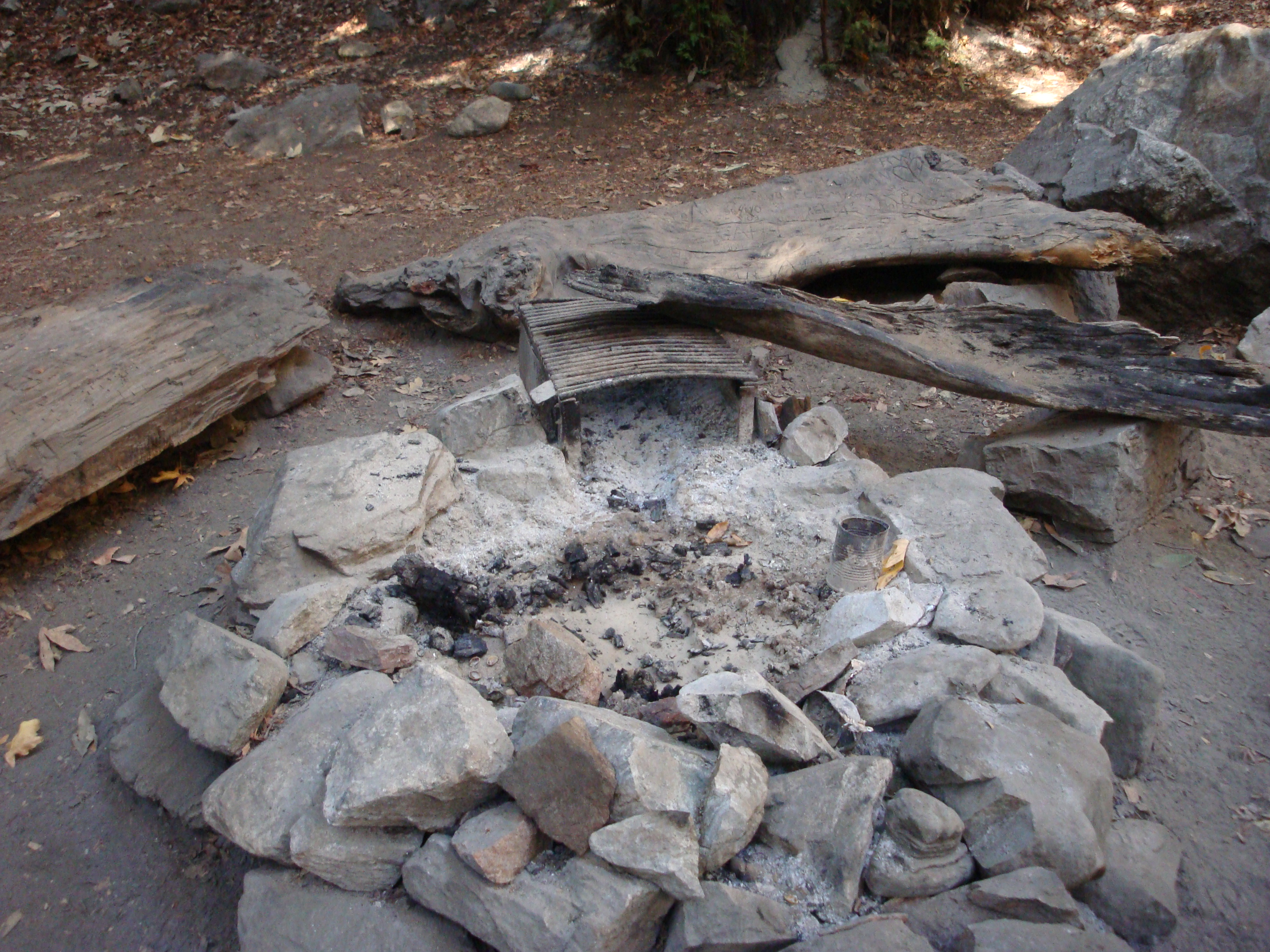
July 7, 2016
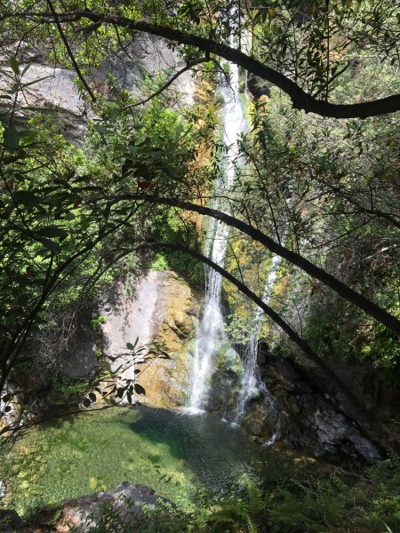
Salmon Creek Falls
A massive surge in the number of visitors to Monterey County in general and Big Sur in particular has led to a large increase in the number of people camping along, and near, Highway One and other roads. While many of these people are, no doubt, careful to leave no trace of their visit, others light illegal campfires and leave their garbage strewn across the landscape. Read the rest of this entry »
17 Comments | Big Sur, On Foot, Santa Lucias | Permalink
Posted by xasauan
March 15, 2016

High water doesn’t last long on the volatile Nacimiento River
News of reservoirs reaching capacity has been coming in from around Northern and Central California this week but, for the Salinas Valley, water remains a problem.
As of this morning, the San Antonio Reservoir holds a measly 18,875 acre feet of water. That’s just 6% of capacity and more than 4,000 acre feet less than what’s considered to be its “minimum pool.” Since the lake hit its all-time low of 10,254 acre feet at the beginning of the year, El Niño rains have added less than 9,000 acre feet to storage. And there isn’t a lot of rainy season left. Read the rest of this entry »
4 Comments | Fire, Flood & Apocalypse, Santa Lucias, Water | Tagged: Lake Nacimiento, Lake San Antonio, monterey county, Salinas River, Salinas Valley Groundwater Basin, Salinas Valley Water Project | Permalink
Posted by xasauan