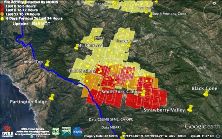
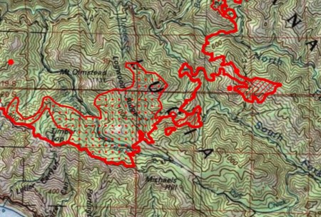
Important caveats: Please note that the squares on the heat detection maps represent the expected margin of error, not the size of the area burned. In other words, the detection could have come from anywhere within the square. Also be aware that false detections do sometimes occur. An outlying or “over the line” heat detection is not, by itself, a confirmation that there is fire in the area indicated. In addition, the satellites do not detect heat everywhere that fire exists. Creeping, backing or smoldering fire is often not detected. Finally, the detections are only snapshots of moments in time. Flare ups that occur before or after a satellite pass may be entirely missed.
Also be aware that yellow squares disappear from the map after 6 days. These are not maps of the area burned since the fire began, just maps of where heat has been detected during the past week.
For more recent updates, please see Soberanes Fire: Week Seven
9-1-16 7:45 pm Update

Week Six closes with the fire becoming active along its southern edge. The light red squares were acquired at around 12:30 pm; the dark red squares a little after 2:00pm.
I’m not sure what to make of the outlying heat detection way off to the east in the Zig Zag Creek drainage. No heat was detected there an hour and a half later, when the second satellite made its pass, so I’m going to assume it’s an error until proven otherwise.
At the far western end of the long southern fire front detected by the 2:00 pm satellite there is a detection on the wrong side of the Coast Ridge fire line, on the Middle Fork of Partington Creek. A spot over the line was reported in this area last night, but it was supposedly only a 50 x 50 spot that was put out this morning, long before this heat detection was acquired. Like the outlying spot to the east, I’m going to assume this is an error until proven otherwise.
In spite of the increased activity, the fire still appears to be burning mostly north of Pick Creek. The eastern edge is now extremely close to, if not already in, the Zig Zag Creek drainage. This will mark, or has marked, the first time the fire has crossed into the Arroyo Seco/Salinas River watershed.
The official numbers for the Soberanes Fire have not been updated this evening. The Chimney Fire remains 46,344 acres. Containment is now 93%.
9-1-16 8:30 am Update

The fire became less active overnight, with some heat still showing along the South Fork of the Big Sur River and on the ridge to the east at 11:00 pm, but no new heat detections in those areas at 3:00 am.
Meanwhile, firing operations were finally able to begin again along the Coast Ridge fire line near Cold Springs. The detections to the left were acquired at 11:00 pm and the one on the right a 3:00 am. The Forest Service says “firing operations along the Coast Ridge Road are keeping up with active fire inside the containment lines to increase the probability of holding the fire east of the Coast Ridge Rd.”
There is no evidence of the main fire front having progressed further south across the Pick Creek drainage.
This morning’s official numbers for the Soberanes Fire: 94,180 acres; 60% contained; 57 homes destroyed; 11 outbuildings destroyed; 1 fatality; 4 injuries.
There were, once again, no new heat detections on the all-but-out Chimney Fire. It remains 46,344 acres. Containment is up to 91%.
8-31-16 6:00 pm Update

There’s been a lot of smoke rising from the Soberanes Fire this afternoon and this is why. The good news is that this flare up appears to be spreading mostly east, toward Strawberry Valley and Black Cone, rather than south across Pick Creek and on toward the Coast Ridge.
The bad news is that these heat detections were acquired around noon and 1:30 pm – just as this flare up was starting. How far it’s spread since then, and in what direction, is hard to say.
This evening’s official numbers for the Soberanes Fire: 93,714 acres; 60% contained; 57 homes destroyed; 11 outbuildings destroyed; 1 fatality; 4 injuries.
While there were still no new heat detections on the Chimney Fire, which remains 46,344 acres and 85% contained, a new fire broke out near Lake Nacimiento today. It sounds like they may have already knocked it down. Thanks to the Chimney Fire burn zone, it couldn’t have moved very far to the north or west anyway.
8-31-16 7:00 am Update
The satellites failed to detect any heat over the Soberanes and Chimney Fires last night. Some burning continues, of course, but at the moment, fire is mostly smoldering and waiting for better burning conditions.
The official numbers for the Soberanes Fire have not been updated this morning. Containment for the Chimney Fire is up to 85%.
8-30-16 7:15 pm Update
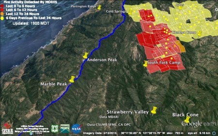
The fire clearly became more active again this afternoon. The two light red heat detections were acquired around 11:00 am this morning. The far more numerous dark red detections were acquired around 2:30 pm this afternoon. They depict fire actively spreading south along a line stretching from the Coast Ridge above Partington Creek, east along the north bank of Pick Creek and across the South Fork of the Big Sur River.
The official numbers for the Soberanes Fire have not been updated this evening.
No new heat was detected on the Chimney Fire today and containment is up to 80%. Hopefully, it will soon be fully contained.
This evening’s official numbers for the Chimney Fire: 46,344 acres; 80% contained; 49 residences destroyed; 21 other structures destroyed; 8 structures damaged; 1 injury.
8-30-16 8:45 am Update

These heat detections, from around 11:00 pm last night, indicate that, by that time, the Soberanes Fire had entered the headwaters of Pick Creek and might even have reached the fire line in that area. There are also new heat detections further to the east, along the ridge between the Big Sur River Forks. Fortunately, there is no sign of any large-scale wind driven run to the south.
Another satellite pass, around 3:00 am this morning, recorded no heat detections. Either there was a huge reduction in fire activity over those four hours or the satellite wasn’t functioning properly. Given the amount of smoke still drifting from the fire this morning, it’s hard to believe that all active burning ceased.
Today’s infrared map is also a bit confusing. It says it’s based on data collected two days ago (8/28), but includes yesterday’s flare ups. It looks like it’s actually based on data collected sometime before the 11:00 pm satellite pass yesterday evening.

The infrared map shows the fire just entering the Pick Creek drainage, as well as spreading along the ridge between the Big Sur River Forks. There is also an area of intense heat (not depicted here) where the satellite found heat yesterday behind Mt. Manuel. The infrared map places this flare up (which is well inside the fire perimeter) along lower Doolan’s Hole Creek.
The infrared map also found an area of intense heat east of the Carmel River near Sulphur Springs. The Forest Service says this flare up may cross the Carmel River and run up the Bruce Fork.
This morning’s official numbers for the Soberanes Fire: 93,245 acres; 60% contained; 57 homes destroyed; 11 outbuildings destroyed; 1 fatality; 4 injuries.

The only heat detected on the Chimney Fire last night was well inside the fire perimeter.
This morning’s official numbers for the Chimney Fire: 46,344 acres; 75% contained; 49 residences destroyed; 21 other structures destroyed; 8 structures damaged; 1 injury.
8-29-16 6:45 pm Update
As soon as winds began to be felt today, fire flared up along the South Fork of the Big Sur River and on the back side of Mt. Manuel, near the Ventana Creek/Big Sur River confluence. The light red detections were acquired around noon, the dark red around 1:30 pm.
Winds have only increased since these detections were recorded, and are expected to get stronger still, and more northeasterly, as the evening wears on. Unsurprisingly, the burning, judging from the smoke, has grown more intense since the last satellite pass.
Here’s a closer look at the area responsible for the large column currently rising. Active burning appears to have been occurring all the way from Logwood Ridge east across the South Fork Big Sur River and up onto the ridge between the Big Sur Forks. As of 1:30 pm, the fire could have been as far east as South Fork Camp. It could, obviously, be further by now.
The concern is that tonight’s winds could blow this fire south across the Pick Creek drainage, then uphill toward the Coast Ridge fire line. The Forest Service says they attempted to conduct firing operations on that line today, but “the test burn was ineffective so firing was not implemented.”
The Forest Service also reports a flare up on a ridge above the Los Padres Reservoir. This may have happened too late to be spotted by the satellites.
This evening’s official numbers for the Soberanes Fire: 92,314 acres; 60% contained; 57 homes destroyed; 11 outbuildings destroyed; 1 fatality; 4 injuries.
Fire activity, some of which may be the result of firing operations, also increased on the Chimney Fire today. All heat detections, as of 1:30 pm appear to be safely within the latest containment lines.
In other good news, all Chimney Fire evacuations are lifted, as of 5:00 pm this afternoon, and containment has jumped to 70%.
This evening’s official numbers for the Chimney Fire: 46,344 acres; 70% contained; 49 residences destroyed; 21 other structures destroyed; 8 structures damaged; 1 injury.
8-29-16 7:00 am Update
It was the marine layer, rather than any increase in wind, that was in control over the Soberanes Fire last night. No new heat detections were recorded.
North to northeast winds with gusts to 25 mph are expected over the Coast Ridge later this afternoon and tonight.
This morning’s infrared map, based on data acquired around midnight, still finds a couple of zones of concentrated heat near the South Fork Big Sur River.
The official numbers for the Soberanes Fire have not yet been updated this morning.
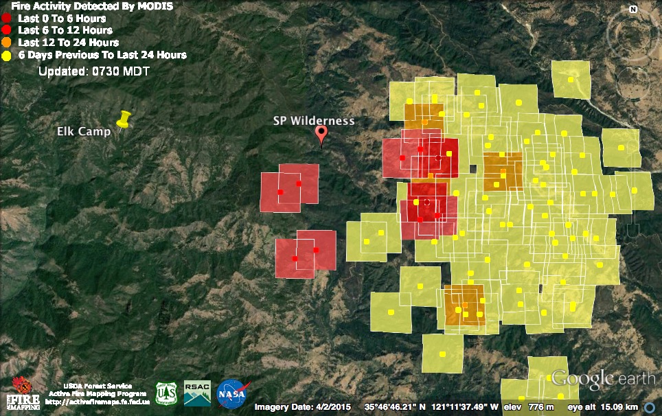
The Chimney Fire, on the other hand, remained active overnight. The outlying heat detections look like the start of the rumored large-scale firing operation. Light red squares represent heat detections acquired around 10:30 pm last night; dark squares were detected at around 2:30 am this morning.
This morning’s official numbers for the Chimney Fire: 45,844 acres; 61% contained; 49 residences destroyed; 21 other structures destroyed; 8 structures damaged; 1 injury.
8-28-16 9:15 pm Update
The fire along the South Fork of the Big Sur River was beginning to get active again when the satellite passed over at about 2:30 pm this afternoon. At 6:00 pm, an evacuation warning (not an order) was issued for the portions of the coast closest to this burning (east side of the Highway from Castro Canyon <i.e. Deetjen’s> to Julia Pfeiffer Burns State Park).
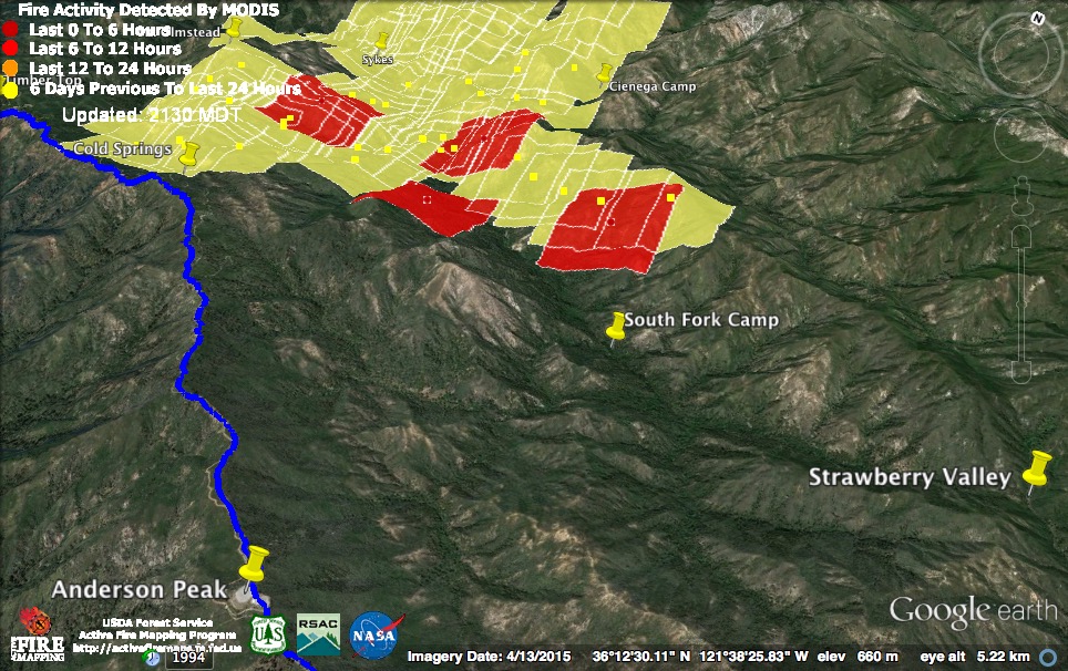
The warning, which was issued by the Forest Service team now managing the fire, actually states a reason, which is certainly refreshing. It says the warning is necessary “due to an expected increase in wind associated with a passing weather front forecast from Sunday evening through Tuesday evening.” Obviously, they are concerned that wind could blow the fire now burning along the South Fork toward the still-unfired line between Cold Springs and Anderson Peak. The good news for residents of the warning area is that even if the fire crosses the line, it will still have to burn downhill into cooler, damper conditions (as happened in the Big Sur Valley) before it reaches anyone’s home.
There were no new heat detections on other parts of the Soberanes Fire today.
This evening’s official numbers for the Soberanes Fire: 91,802 acres; 60% contained; 57 homes destroyed; 11 outbuildings destroyed; 1 fatality; 4 injuries.
Active burning was also detected on the Chimney Fire today. Especially on the western front closest to the Silver Peak Wilderness. There are reports that Cal Fire is planning a large (4,000 acre) burn out operation in the hopes of finally stopping the Chimney Fire once and for all.
In the meantime, the expected wind event will probably create a risk of new flare ups and runs.
This evening’s official numbers for the Chimney Fire: 45,108 acres; 60% contained; 49 residences destroyed; 21 other structures destroyed; 8 structures damaged; 1 injury.
8-28-16 7:00 am Update
The marine layer remains thick and there were no heat detections overnight on the Soberanes Fire.
The official numbers for the Soberanes Fire have not yet been updated this morning.

A satellite pass at around 11:30 pm last night found renewed fire activity on the northwest corner of the Chimney Fire. This morning’s report from Cal Fire says fire “continues to challenge control lines on the northwest and southwest fire line,” but that sentence has been in their reports for several days now, so it may not have anything to do with this latest flare up.
This morning’s infrared map, based on data collected about an hour earlier than these heat detections (at 10:30 pm), shows a patch of intense heat further to the south along the western edge of the fire, but only scattered heat in the northwest corner.
The official numbers for the Chimney Fire have not been updated this morning.
8-27-16 10:45 pm Update

Heat detections acquired at around noon and 2:00 pm today suggest that the flare up on the ridge between the Big Sur River forks is now following that ridge east toward Strawberry Valley and Black Cone.
The only other heat detection was on the high ridge to the east of the Ventana Double Cone. A photo of that hot spot, taken today, shows it burning on the Carmel River side of the divide close to a brushy saddle known to some of us as Heartbreak Pass.
This evening’s official numbers for the Soberanes Fire: 91,543 acres; 60% contained; 57 homes destroyed; 11 outbuildings destroyed; 1 fatality; 4 injuries.
There were no new heat detections on the Chimney Fire today, but this fire has roared back to life so many times now that celebrating would probably be premature.
This evening’s official numbers for the Chimney Fire: 45,108 acres; 52% contained; 49 residences destroyed; 21 other structures destroyed; 8 structures damaged; 1 injury.
8-27-16 7:00 am Update
The marine layer was almost 3,000 feet thick yesterday and last night. As a result, for the first time since the fires began, the satellites detected no heat over the Soberanes and Chimney Fires. This does not mean that the fires are out; only that burning has been suppressed to the point that it is difficult to detect from orbit.
The closer-to-the-ground infrared flight, around midnight last night, was able to find a couple of areas of concentrated heat on the fire’s southern end. One in the Mocho Creek drainage, and one around yesterday’s flare-up on the ridge between the Big Sur River forks.
Notice how the mapping people dealt with this flare-up; drawing a narrow neck out to it from their previous perimeter, then circling it. The point is that the perimeter lines drawn on these and other fire maps are guesses. They are created by drawing what seems like a plausible line around satellite or infrared heat detections. The resulting lines are somewhat misleading, as they create, inaccurately, the impression that the fire has a clear cut boundary and that the exact position of that boundary at one or another point in time is precisely known.
This is why I generally prefer to look at heat detection data by itself – it’s easier to remember that not all burning is being detected and that there is a wide margin of error.
Click here to view this morning’s infrared map in its entirety.
Official numbers have not been updated for either fire as yet this morning.
8-26-16 9:45 pm Update

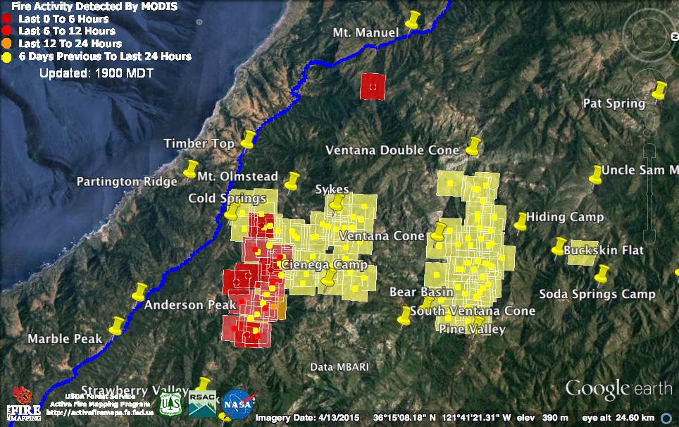
Active burning remained limited on the Soberanes Fire today. The 11:30 am satellite pass found the flare up that had been burning last night near the Ventana Spires moving north into the headwaters of Ventana Mesa Creek and east toward the Carmel River.
The 3:00 pm satellite found active fire well out ahead of previous detections along the slopes north of the South Fork Big Sur River. This is a good example of the limitations of both heat detecting satellites and infrared scans from helicopters. They only capture moments in time and often miss smoldering fire. Fire can burn well beyond the areas where heat has been detected, then suddenly flare up well ahead of the supposed “fire perimeter.”
The official numbers for the Soberanes Fire have not been updated this evening.

The 3:00 pm satellite found an active fire front at the north end of the Chimney Fire. Later in the afternoon, there were (once again) reports of the fire jumping containment lines in this area.
This evening’s official numbers for the Chimney Fire: 45,008 acres; 51% contained; 49 residences destroyed; 21 other structures destroyed; 8 structures damaged; 1 injury.
8-26-16 7:30 am Update
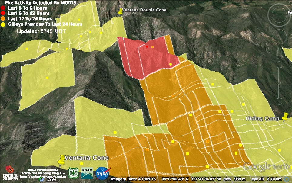
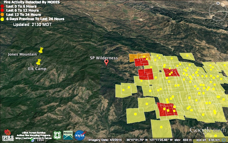
A deep marine layer pushed inland during the night suppressing most burning on the Soberanes Fire as it began its sixth week. The only overnight heat detection came from the Ventana Spires area, near the Double Cone – not coincidentally one of the highest elevation spots in the fire area. That heat was detected around 11:30 pm last night.
This morning’s official numbers for the Soberanes Fire: 91,100 acres burned; 60% contained; 57 homes destroyed; 11 outbuildings destroyed; 3 structures damaged; 2 outbuildings damaged; 1 fatality; 4 injuries.

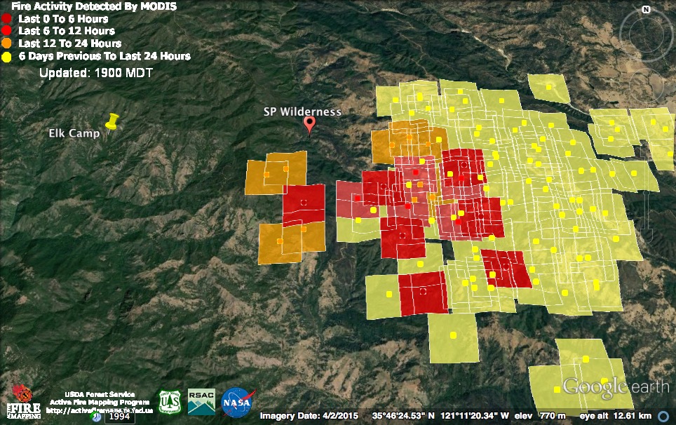
The marine layer also put a damper on the Chimney Fire. Cal Fire says winds pushed fire southwest toward Hearst Castle again yesterday, but this was missed by the satellites. Much will depend on how dry it gets over the fire today and the direction of the afternoon wind. The marker designated “SP Wilderness” indicates the approximate location of the southeast corner of the Silver Peak Wilderness.
This morning’s official numbers for the Chimney Fire: 45,008 acres; 47% contained; 49 residences destroyed; 21 other structures destroyed; 8 structures damaged; 1 injury.
For earlier updates, please see Soberanes Fire: Week Five

I’m wondering if any of the santa lucia fir stands along the VDC ridge-line(s) will survive this. I know a bunch of them got wiped out in ‘ 08.
Marine layer heavy in San Diego the past 2-3 days too. Thank god we still have a marine layer in California! Sometimes it seems to disappear for years (or many many months) on end.
lewruli – “I’m wondering if any of the santa lucia fir stands along the VDC ridge-line(s) will survive this. I know a bunch of them got wiped out in ‘ 08.”
—————————————–
Yes, I was wondering about Santa Lucia Firs as well. I’ve never seen them in the wild, but always wanted to. Here is a range map and photos of the Santa Lucia or bristlecone fir (Abies bracteata), which could be considered the rarest fir in North America. And I dod remember this being mentioned in the context of the earlier fires years back. Take note of one picture of the north face of Cone Peak and the unfortunate mortality of Santa Lucia fir back in this June 2015 post. Seems many were having as much trouble with survival like other trees there long before this wildfire.
http://blog.conifercountry.com/2015/06/cone-peak-conifers/
Here is another nice blog post and photos of the area’s Santa Lucia hotspots. This was written back in January of this year 2016. His photos also reveal the dying of some trees. He also references the Silver Peak Wilderness spoken about in this blog with reference to the Chimney Fire. I guess that have a number of woodlands there also.
Santa Lucia Firs most often grow in rocky places where vegetation is sparse enough that they are somewhat protected from fire. This is why they have fared better than the big pine forests during the repeated fires of recent years. Each fire does kill some, though, and any loss of such a rare species is a concern – especially with so many dying of drought stress, or other unknown causes.
As far as the santa lucia fir goes, I know of two stands on Hearst ranch. 1 on marnelejo cr and further north on the north slope of Pine Top. Another stand resides on Carp east of Baldwin ranch. The Silver Peak wilderness holds 4 or more small scatterings, usually on rocky northern exposures
More on Abies bracteata from the Ventana Wilderness Alliance website:
http://www.ventanawild.org/news/fe98/slfirs.html
So far it looks like many of the large Santa Lucia Fir groves have avoided fire including Kandlbinder, VDC, Upper Ventana Mesa Creek, north side of Ventana Cone, Pine Falls to Pine Valley, and Miller Fork. I suspect the 2008 fire was able to penetrate these groves more due to that fire’s greater intensity/speed and more brush growth around the groves (it takes awhile for brush to take hold in the steep and rocky terrain that the Santa Lucias inhabit). The lower elevation groves and southern pockets in the Silver Peak Wilderness seem to be under the most drought stress while the upper elevation groves looked largely healthy as of last winter/spring.
It’s said 60% contained for, it seems, a month now. What’s going on? Is this fire almost out, or is it still burning?
Is there still a fire? Or is it completely man made now?
Because I can see carmel valley, cachagua and big sur from my house and in the am there is no smoke at all. It starts up around noon everyday, I’m very confused
Burning conditions are usually better in the afternoon, which is why the fire gets more active then. Some of the fire is the result of firing operations, but without those firing operations there would be much more risk to homes on Partington Ridge and along the coast.