Saturday, June 21, 2008; one year ago today
A warm, sunny and unusually humid day.
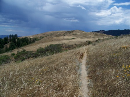
12:45pm: A dark band of clouds appears off the coast.
1:25pm: The cloud band passes quickly overhead, flashing with lightning.
1:40pm: The sun comes out again.
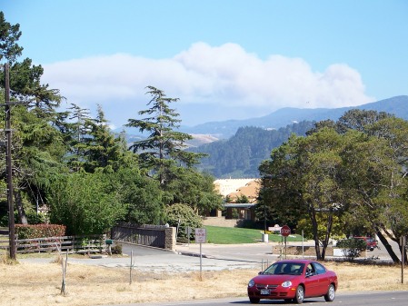
Except over Monterey Bay where the weather is seriously deteriorating.
3:45pm Rising smoke is visible from Lighthouse Flats as the Gallery Fire gets underway.
Lightning started around 600 fires in Northern California that afternoon, severely straining firefighting resources. The Forest Service reported two lightning sparked fires in the Big Sur area; the Gallery Fire, ignited just above the Coast Gallery at Lafler Canyon, and the Basin Fire, ignited near Bear Basin, deep in the Ventana Wilderness. People hiking in the Wilderness later reported seeing a third fire burning in the vicinity of Mt. Olmstead.
By late Saturday, the Gallery Fire was sweeping north toward the Big Sur Valley along the western flanks of the Coast Ridge. The heat detecting satellites didn’t find a fire on Mt. Olmstead, but they did find a fire behind Timber Top (where it could easily have been mistaken for a fire on Mt. Olmstead by people on the Pine Ridge Trail). This second fire is the smaller red zone.
With the fire headed straight toward the Big Sur Valley and, even more immediately, toward the populated area at the north end of the Coast Ridge, it’s not surprising that firefighting efforts were concentrated along the northern end of the Coast Ridge Rd. But the prevailing north winds were bound to return soon and blow the fire south, so it’s a shame that not even one dozer crew was available to throw in a line to the South of the fire before it was too late.
Please Note: We’ve produced these fire maps, based on satellite heat detection data and eyewitness accounts. We think they’re a lot more accurate than the fire maps the Forest Service issued – not a difficult thing to achieve – but they’re still approximations. We have not attempted to trace the perimeter of the burn area exactly or to indicate areas inside the fire perimeter that didn’t burn. Please also note that north and south are generally defined by the coastline in Big Sur, rather than by the compass – so (for you purists) what we refer to as south is often actually closer to being east, and north is often closer to being west.
With no firefighting resources to spare, the Basin Fire, deep in the Ventana Wilderness, was left to burn unattended. By late on Saturday it had covered an area about like this.
Sunday, June 22, 2008
See what we mean about getting a line built to the south? On Sunday the prevailing winds returned and sent the Gallery Fire flying south along the Coast Ridge, where it combined with the fire behind Timber Top – an eastern arm reaching as far as the saddle between Mt. Olmstead and Cold Springs. On the other side of the ridge, the fire entered the Partington Creek watershed and began threatening the homes on Partington Ridge.
Left to its own devices, the Basin Fire grew slowly on Sunday, with the exception of a run to the top of the ridge between Ventana Cone and Pine Ridge. The expanding Gallery Fire can be seen in the background.
Gallery Fire smoke plume as seen from Carmel. 5:00pm June 22.
Monday June 23
The marine layer failed to form Sunday night and the fires expanded rapidly. By Monday morning, the Gallery Fire looked something like this. It had moved north far enough to overlook the Big Sur Valley, it was backing down the canyons toward Deetjens and the Henry Miller Library, and homes on Partington Ridge were burning. It had burned over the top of Mt. Olmstead and was backing down the other side toward the forks of the Big Sur River. On the eastern end, it was burning into Pick Valley. More structures were probably destroyed this morning than at any other time during the Basin Complex Fire.
Meanwhile, the Basin Fire was off on adventures of its own. On its north side, it descended to the Carmel River in the remote area downstream of Pine Falls. On its south side, it burned over Pine Ridge and descended toward the Big Sur River nearly to Cienega and Redwood Camps.
Basin Fire plume as seen from Chew’s Ridge. Late afternoon, June 23 Photo: Don Gruber
Tuesday, June 24
Yikes! With hot, dry conditions continuing, the fires made huge runs Monday and Monday night, and by Tuesday morning the fires had more or less doubled in size – although firefighters succeeded in preventing the fire from burning further toward the Big Sur Valley by holding the line at the north end of the Coast Ridge.
Although its northern edge had come to a stop at the Carmel River, the Basin Fire’s southern flank had burned through Redwood Camp and was descending toward the Big Sur River. Its western side had burned over the top of Ventana Cone and moved deep into the Lion Creek watershed – even reaching, in one spot, the ridge overlooking the headwaters of Ventana Creek. The nothern arm of the Gallery Fire (on the right) had reached the Big Sur River in the vicinity of Sykes Hot Springs. Another arm had crossed the South Fork, made a run over the ridge, and descended all the way to the North Fork.
But the biggest run of all was on the south side of the Gallery Fire, where fire burned over Anderson and Marble Peaks, then hung a left and burned across the high country almost all the way to the summit of Black Cone.
Meanwhile, the slower moving eastern side of the Basin Fire had burned over South Ventana Cone into the upper watershed of Tassajara Creek and was making a run along the ridge toward the Church Creek Divide.
Gallery Fire plume as seen from upper Garrapata Ridge; 2:00pm, June 24 Photo: Lloyd Jones
Wednesday, June 25
By Wednesday morning the fires had burned together, becoming in reality, as well as in name, a single fire “complex.” In the northwest, the fire had reached Ventana Creek and the foot of the Double Cone’s south face, climbed the backside of Island Mtn., and moved down the main stem of the Big Sur River in the vicinity of Barlow Flats. In the North, it remained stalled along the Carmel River. In the east, it had reached the top of the hill above the Church Creek Divide and had chewed through more of the upper Big Sur River watershed. In the south it had moved across the upper slopes of Anderson Canyon to the edge of Hot Springs Canyon.
But the marine layer moved back in Wednesday morning and the fire began to slow down. The Henry Miller Library was successfully defended as the fire crept slowly down the hill into its backyard.
Thursday, June 26
Not much changed in 24 hours, as most of the fire had a quiet day. A new run out of the Big Sur River tested the containment at the north end of the Coast Ridge and the fire continued its steady march to the south, but otherwise things were generally calm.
If there’s sufficient interest in the topic, we’ll continue following the progression of the fire through the breaching of the Big Sur and Chew’s Ridge fire lines, the mandatory evacuation debacles, etc. in later posts … But that’s enough for now!


WOW!!! You did a fantastic job here, XT. I will definitely be linking to this on my anniversary page today. Yes, please, I know this is a lot of work, but I would like to follow this through until containment.
My God, have you ever read the opening section of Robinson Jeffers’ ‘The Women of Point Sur’? Those first shots of the clouds gathering on the 21st look just like what Jeffers described.
Yes, the section about Onorio Vasquez watching the storm to the north from the “breast of Palo Corona mountain” is more than a close fit with those shots. Thanks for pointing that out. – XT This passage seems particularly apt:
The long yellow beam wheels over the wild sea and the
strain
Gathers in the air.
Oh crucified
Wings, orange eyes, open?
Always the strain, the straining flesh, who feels what
God feels
Knows the straining flesh, the aching desires,
The enormous water straining its bounds, the electric
Strain in the cloud, the strain of the oil in the oil-
tanks
At Monterey, aching to burn, the strain of the spinning
Demons that make an atom, straining to fly asunder,
Straining to rest at the center,
The strain in the skull, blind strains, force and counter-
force,
Nothing prevails …
I really enjoyed your thurough “play by play” of Basin and all of the amazing effort everyone put in during the fire to keep us informed.
Only one thing might need saying. The terrain and high heat really are more to blame for the fire’s spread than any lack of resources. As I stumbled off Grimes Point exhausted, I was laid low by the steep terrain that made it nearly impossible to fight the fire. or even catch up to it. Men and women in fire service are not super heroes, they only have two legs and two arms and a tool to face the beast. Further, rolling material caused the fire to make runs at night when it is basically impossible to fight the fire.
18 Watch out Situations of Wildland Firefighting
2nd:Country not seen in daylight. 8th: constructing line down hill with fire below. 13th: on a hillside where rolling material can ignite fuels below.
I am glad no lives were lost and that the countryside now blooms in a new day.
You’re providing invaluable documentation for fire ecologists (and fire mangers too, I suspect) so please continue.
This must take a LOT of work,
but I hope you find the time to keep it coming
(& archive these observations for posterity!)
kudos.
Bravo, amigo.
Thank you. What a major event for all of us. In the moment there is so much happening all at once & communications, such as they are, leave us all wanting for information. I appreciate all the gaps you’ve filled in. You guys are great!