Bomb Cyclone Gets the Hype, But Atmospheric River Delivers the Goods as Rainy Season Gets Underway

December 2, 2019

IMG_4394

The first storm of the season brings snow to Mt. Toro and the Sierra de Salinas

A couple of weeks ago it seemed like the rainy season might never arrive. But that all changed last Tuesday (November 26) when a much-hyped “bomb cyclone” sent a wave of rain sweeping across the state.

For the record, a bomb cyclone is simply a mid-latitude weather system that strengthens rapidly enough that it drops in pressure by 24 millibars, or more, in 24 hours. A storm that strengthens more slowly can still get just as strong.

This storm met the definition easily, as it shed 43 millibars in 24 hours, while approaching landfall near the California/Oregon border. As it came ashore, the Crescent City Airport recorded a pressure of 973.4 millibars, a record low for the state of California. Rain and snow then spread across the state, closing roads and complicating Thanksgiving travel plans.

Here in Monterey County, the highest rain totals were recorded on the southernmost coastal ridges, with Chalk Peak, above Pacific Valley, and Three Peaks, above Salmon Creek, receiving more than three inches. The central Santa Lucia Mountains got much less, with Mining Ridge and the Ventana Double Cone getting barely more than an inch and Black Cone and Pinyon Peak getting less than an inch. The northernmost hills got a bit more, with White Rock Ridge, above Garrapata logging over two inches.

IMG_4388

Runoff from a deluge unleashed by the bomb cyclone carved ditches across the Carmel Beach

By Friday, the lingering showers had largely faded away, but a new low pressure system was dropping down from the north and pulling warm, moisture-laden air from near Hawaii up toward the California coast. Meteorologists used to love calling this phenomenon a “Pineapple Express,” but in recent years it has come to be known as an “atmospheric river.” Storms of this type have historically been responsible for California’s most extreme, and prolonged, rain events.

The moisture began arriving and the rain began falling early Saturday morning and, as the river barely wavered from its focus on the central to northern Santa Lucia Mountains, the rain fell nearly continuously there for the next 60 or so hours, accompanied by winds that gusted to more than 70 mph. As the river was narrowly focused, locations to the north and south generally received much less rain.

IMG_A5FD54EC885B-1

The narrow focus of the atmospheric river can be seen in this radar image

The rain began moving off to the south and the skies finally cleared only hours ago, but more showers remain a possibility and the low that delivered the moisture is itself expected to bring another round of rain as it comes ashore to the south of us Tuesday evening. A third potent storm may arrive as early as Thursday.

As of now, the evening of Monday, December 2, Mining Ridge, as is so often the case, has received the most rain of any location in Central California with 18.31 inches for the week, 17.25 of which has fallen in the last 72 hours.

Next in line is the Ventana Double Cone, at an elevation of well over 4,000 feet, with 16.03 inches for the week (14.85 in the past 72 hours). The Big Sur Valley has also received a remarkable amount of rain with 11.74 inches for the week (9.29 in the past 72 hours). This is especially impressive since this station is barely above sea level.

The extreme dryness that preceded this rain has prevented any dramatic runoff, but all the rivers are now flowing.

The Big Sur River rose from a flow of about 10 cubic feet per second (cfs) to peak this afternoon at around 1,200 cfs.

The Carmel River filled the ever-shrinking Los Padres Reservoir, began spilling over the dam, and sent a peak flow of around 1,100 cfs downstream – prompting the County to breach the bar at the river mouth.

The Arroyo Seco River, which drains the backside of Mining Ridge, rose from about 20 cfs, to produce the highest peak flow of any local stream, with more than 3,000 cfs.

The San Antonio River, usually the last to begin flowing, went from bone dry to around 1,000 cfs this afternoon – extremely good news for Salinas Valley water users.

By contrast, the Nacimiento River, which usually greatly outperforms the San Antonio in terms of flow, only managed a peak of around 860 cfs – which will be less pleasing to Salinas Valley water users. This probably reflects the fact that the Nacimiento headwaters received far less rain from the atmospheric river than the San Antonio watershed to the north.

Whether the rainy season to come will be wet or dry remains anyone’s guess, but if the storms predicted for this week bring significant additional rainfall, the streams will likely rise much faster.

IMG_9643039043CC-1

A River Runs Through It: The atmospheric river, as tightly focused as ever, begins moving off to the south this afternoon.

The Big (Sur) One

May 1, 2019

Yesterday, April 30, 2019, at 10:10 am, a small, magnitude 3.4 earthquake rocked the seafloor 25 kilometers northwest of San Simeon. That’s just offshore from where the Monterey/San Luis Obispo County line meets the coast; between Salmon Creek and Ragged Point. Local media reported it took place on the San Simeon Fault.

In other words, the quake took place immediately adjacent to some of the most unstable and landslide prone slopes in Big Sur. It was fortunate that this quake was so small, because larger – much larger – earthquakes are distinctly possible along the Big Sur coast.

IMG_2665

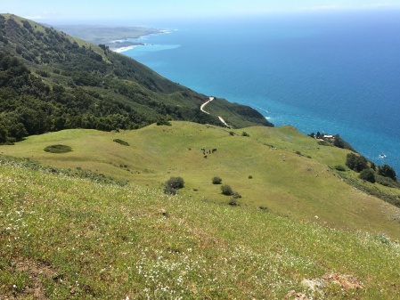
The epicenter of yesterday’s earthquake was just off this segment of the southern Big Sur coast. The cattle grazing in Kozy Kove Meadow make a peaceful, bucolic scene, but it’s worth remembering that the flat is, in fact, the top of an enormous pile of rubble; the remnants of a massive landslide that very recently (in geologic time) slid into the ocean in this location. Read the rest of this entry »


Beyond the Valley of the Super Bloom

April 9, 2019

Where once there were full moons, high tides and wildflower seasons, there are now “Super Moons,” “King Tides,” and “Super Blooms.”

If you miss this month’s once in a century Super Blue Blood Double Wolf Moon, don’t worry. You may rest assured that the once in a millennium Ultra Eye of Sauron Apocalypse Moon coming next month will more than make up for it.
Read the rest of this entry »


Big Sur Highway Management Plan Identifies Congestion Relief Projects

April 1, 2019

DSC06841

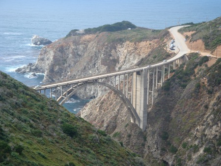
Bixby Bridge

The California Highway Department has finally released its long-awaited management plan for Highway One in Big Sur.

Key issues identified by state planners include increasing levels of traffic brought on by relentless promotion of the area as a vacation destination and the social media-induced tendency of visitors to gather in large numbers at a few highly congested and overused attractions.
Read the rest of this entry »


Despite Flood Warnings, Local Rivers Peak Short of Levels they Reached Last Month

February 14, 2019

IMG_2240

The ocean held the rising Carmel River at bay for awhile this morning, raising the lagoon to “action level,” but the river eventually prevailed and lagoon levels dropped.

When the Carmel and Big Sur Rivers flirted with flood stage last month, it passed largely without notice. They had not been projected to rise that high and so flood alerts weren’t issued.
Read the rest of this entry »


Much Needed Rain

January 18, 2019

img_1930

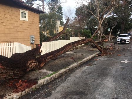
On Wednesday, January 16, 2019, wind gusting to over 50 mph brought down trees and knocked out power – especially on the Monterey Peninsula’s south-facing slopes.
Read the rest of this entry »


With Restrooms Locked, Big Sur Roadsides Sink Deeper into Squalor

June 25, 2018

IMG_2809

Human waste next to locked restrooms at the Forest Service’s Willow Creek Picnic Area

When ya gotta go, ya gotta go and when ya gotta go in Big Sur, finding an appropriate spot can be difficult – especially when the public is locked out of the few facilities that do exist.

Word is that two or three restrooms on the South Coast, which means pretty much all the public restrooms on the South Coast, have been locked for several weeks now. We don’t know why, but this is the predictable result.

IMG_2808

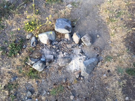
Meanwhile, illegal campfires, like this one lit directly on top of dry grass, continue to threaten new conflagrations.

Welcome to summer…

(Photos by Branham Rendlen) 


Wildflower of the Week: Dudleya

May 13, 2018

IMG_3479

It will take a bold poacher to snag this Dudleya

If a year ago someone had said that Dudleya poaching was about to become a problem along the California Coast, it would have been difficult to believe. But in an increasingly globalized and irrational world, we should probably not be surprised when the not-so-invisible hand of a distant market suddenly reaches out to rip a random thread from the local web of life.
Read the rest of this entry »


Local Streams Shrug Off Atmospheric River

March 22, 2018

IMG_0714

The rain is still falling out there, but it looks like our multi-day storm is beginning to wind down.
Read the rest of this entry »


Forest Service Lifts Fire Restrictions Just in Time for a Red Flag Warning

January 27, 2018

IMG_2266

7:30 pm; June 16, 2016: Sundowner winds blow the Sherpa Fire down from the Santa Ynez Mountains and onto the coastal terraces west of Santa Barbara (as viewed from the comfort of Cojo Anchorage). Dry season conditions of this kind have been common so far this winter.

The Los Padres National Forest covers about 1.75 million acres. The northern boundary, near Carmel Valley, is over 200 miles from the Forest’s southernmost point, near Los Angeles. As fire restrictions are imposed Forest-wide, strict prohibitions on campfires tend to remain in place in the Big Sur area, even after substantial rain, so long as the southern end of the Forest remains dry.
Read the rest of this entry »